Q50A Georgetown, OH, USA - Earthquake Result Viewer
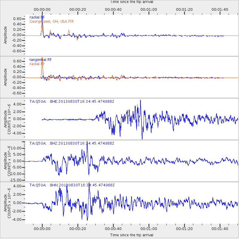
Earthquake location: Andreanof Islands, Aleutian Is.
Earthquake latitude/longitude: 51.5/-175.2
Earthquake time(UTC): 2013/08/30 (242) 16:25:02 GMT
Earthquake Depth: 29 km
Earthquake Magnitude: 7.0 MWW, 6.5 ML, 6.8 MI, 6.9 MWC, 6.9 MWB, 7.0 MWW, 7.0 MI, 7.0 MWC
Earthquake Catalog/Contributor: NEIC PDE/NEIC COMCAT
Network: TA USArray Transportable Network (new EarthScope stations)
Station: Q50A Georgetown, OH, USA
Lat/Lon: 38.84 N/83.98 W
Elevation: 262 m
Distance: 61.5 deg
Az: 62.672 deg
Baz: 314.722 deg
Ray Param: 0.06079081
Estimated Moho Depth: 34.0 km
Estimated Crust Vp/Vs: 1.88
Assumed Crust Vp: 6.232 km/s
Estimated Crust Vs: 3.306 km/s
Estimated Crust Poisson's Ratio: 0.30
Radial Match: 98.48427 %
Radial Bump: 345
Transverse Match: 91.81828 %
Transverse Bump: 400
SOD ConfigId: 626651
Insert Time: 2014-04-18 05:25:23.942 +0000
GWidth: 2.5
Max Bumps: 400
Tol: 0.001

Signal To Noise

ChannelStoNSTALTA
TA:Q50A: :BHZ:20130830T16:34:45.474988Z22.741352.508344E-61.1029883E-7
TA:Q50A: :BHN:20130830T16:34:45.474988Z13.2492149.1866735E-76.93375E-8
TA:Q50A: :BHE:20130830T16:34:45.474988Z15.3244041.0138868E-66.616159E-8
Arrivals
Ps5.0 SECOND
PpPs15 SECOND
PsPs/PpSs20 SECOND