Q54A Coxs Mills, WV, USA - Earthquake Result Viewer
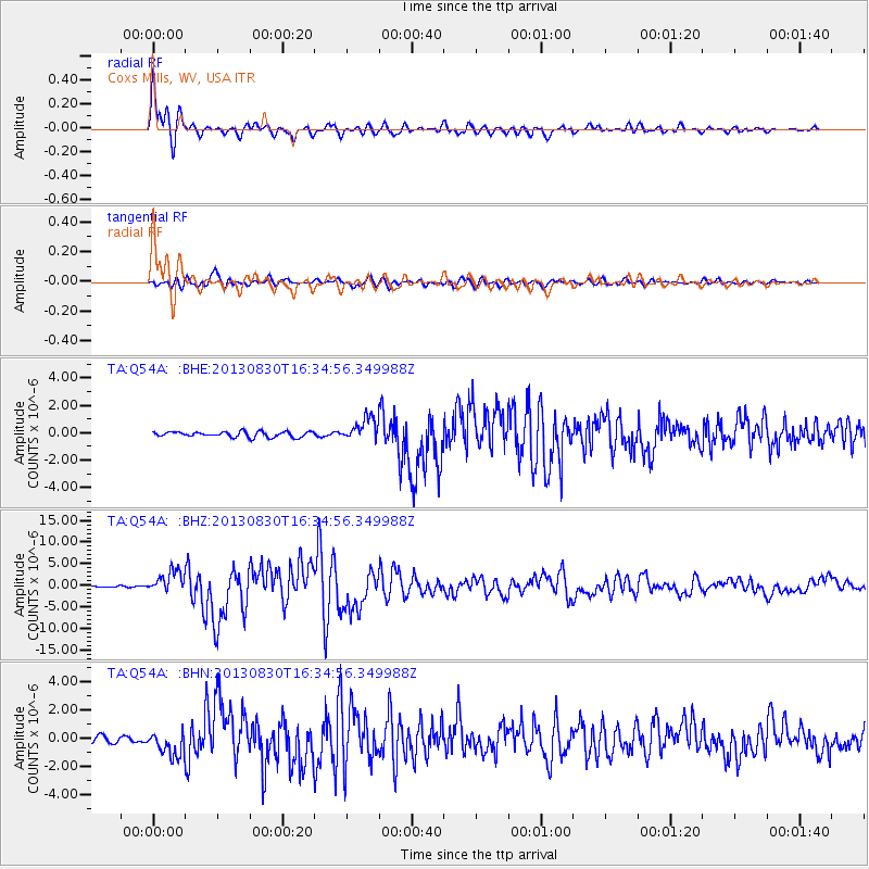
Earthquake location: Andreanof Islands, Aleutian Is.
Earthquake latitude/longitude: 51.5/-175.2
Earthquake time(UTC): 2013/08/30 (242) 16:25:02 GMT
Earthquake Depth: 29 km
Earthquake Magnitude: 7.0 MWW, 6.5 ML, 6.8 MI, 6.9 MWC, 6.9 MWB, 7.0 MWW, 7.0 MI, 7.0 MWC
Earthquake Catalog/Contributor: NEIC PDE/NEIC COMCAT
Network: TA USArray Transportable Network (new EarthScope stations)
Station: Q54A Coxs Mills, WV, USA
Lat/Lon: 38.98 N/80.83 W
Elevation: 254 m
Distance: 63.1 deg
Az: 60.594 deg
Baz: 315.724 deg
Ray Param: 0.059733912
Estimated Moho Depth: 35.25 km
Estimated Crust Vp/Vs: 1.70
Assumed Crust Vp: 6.207 km/s
Estimated Crust Vs: 3.651 km/s
Estimated Crust Poisson's Ratio: 0.24
Radial Match: 95.70854 %
Radial Bump: 400
Transverse Match: 84.71468 %
Transverse Bump: 400
SOD ConfigId: 626651
Insert Time: 2014-04-18 05:25:33.635 +0000
GWidth: 2.5
Max Bumps: 400
Tol: 0.001

Signal To Noise

ChannelStoNSTALTA
TA:Q54A: :BHZ:20130830T16:34:56.349988Z15.6241052.5336467E-61.6216268E-7
TA:Q54A: :BHN:20130830T16:34:56.349988Z3.21398858.8990475E-72.7688486E-7
TA:Q54A: :BHE:20130830T16:34:56.349988Z4.16736658.329835E-71.9988248E-7
Arrivals
Ps4.1 SECOND
PpPs15 SECOND
PsPs/PpSs19 SECOND