R55A Marlinton, WV, USA - Earthquake Result Viewer
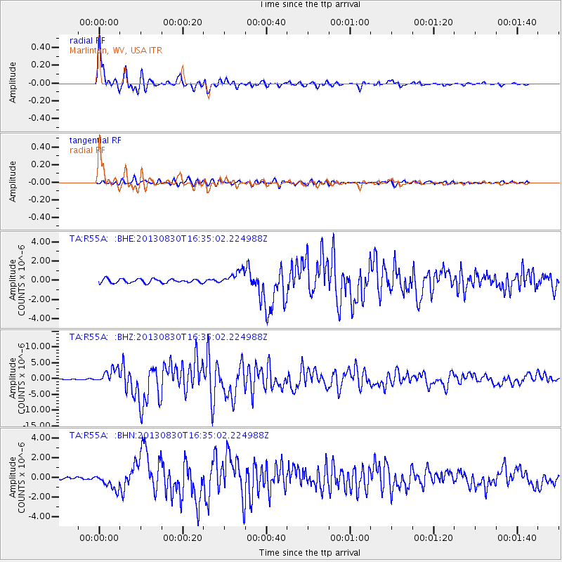
Earthquake location: Andreanof Islands, Aleutian Is.
Earthquake latitude/longitude: 51.5/-175.2
Earthquake time(UTC): 2013/08/30 (242) 16:25:02 GMT
Earthquake Depth: 29 km
Earthquake Magnitude: 7.0 MWW, 6.5 ML, 6.8 MI, 6.9 MWC, 6.9 MWB, 7.0 MWW, 7.0 MI, 7.0 MWC
Earthquake Catalog/Contributor: NEIC PDE/NEIC COMCAT
Network: TA USArray Transportable Network (new EarthScope stations)
Station: R55A Marlinton, WV, USA
Lat/Lon: 38.28 N/80.12 W
Elevation: 833 m
Distance: 64.0 deg
Az: 60.688 deg
Baz: 316.21 deg
Ray Param: 0.05915056
Estimated Moho Depth: 43.75 km
Estimated Crust Vp/Vs: 1.88
Assumed Crust Vp: 6.207 km/s
Estimated Crust Vs: 3.293 km/s
Estimated Crust Poisson's Ratio: 0.30
Radial Match: 97.7383 %
Radial Bump: 400
Transverse Match: 88.176865 %
Transverse Bump: 400
SOD ConfigId: 626651
Insert Time: 2014-04-18 05:26:10.429 +0000
GWidth: 2.5
Max Bumps: 400
Tol: 0.001

Signal To Noise

ChannelStoNSTALTA
TA:R55A: :BHZ:20130830T16:35:02.224988Z14.2364692.3604061E-61.6579997E-7
TA:R55A: :BHN:20130830T16:35:02.224988Z6.8836348.4833397E-71.2323926E-7
TA:R55A: :BHE:20130830T16:35:02.224988Z3.79672747.646616E-72.0140017E-7
Arrivals
Ps6.5 SECOND
PpPs20 SECOND
PsPs/PpSs26 SECOND