
S51A Beattyville, KY, USA - Earthquake Result Viewer
| ||||||||||||||||||
| ||||||||||||||||||
| ||||||||||||||||||
|
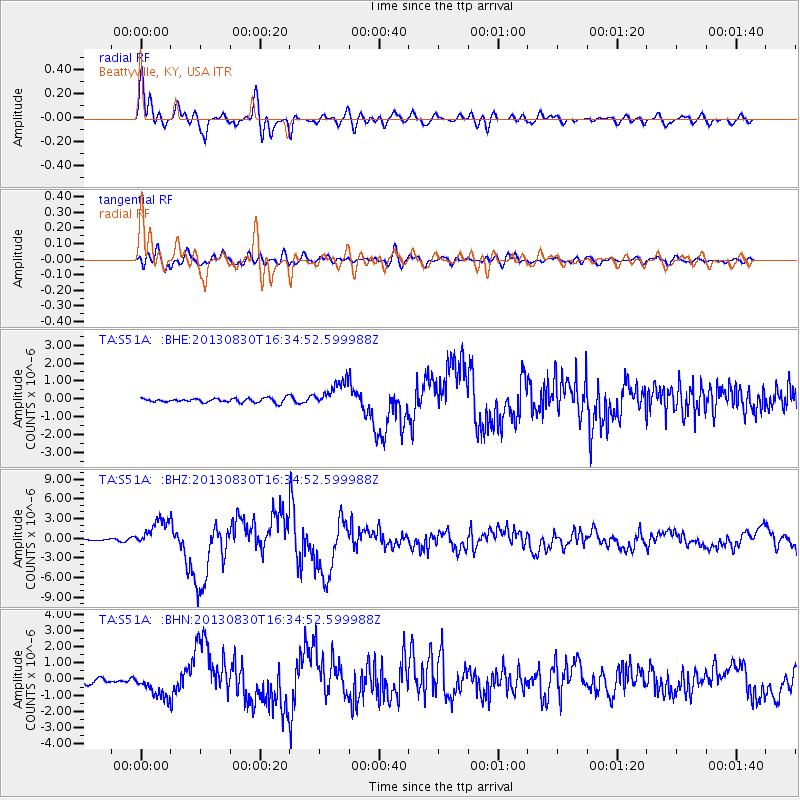
Signal To Noise
| Channel | StoN | STA | LTA |
| TA:S51A: :BHZ:20130830T16:34:52.599988Z | 14.718509 | 2.1390642E-6 | 1.4533158E-7 |
| TA:S51A: :BHN:20130830T16:34:52.599988Z | 4.914895 | 7.6570143E-7 | 1.5579202E-7 |
| TA:S51A: :BHE:20130830T16:34:52.599988Z | 6.161828 | 7.1202766E-7 | 1.15554606E-7 |
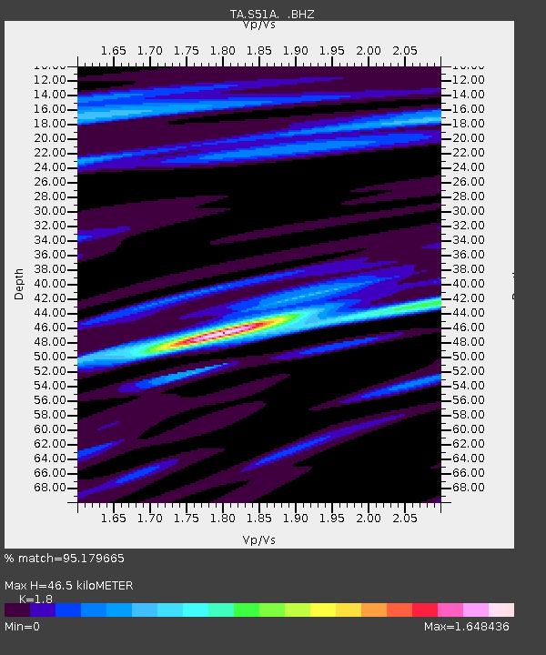
| Arrivals | |
| Ps | 6.0 SECOND |
| PpPs | 19 SECOND |
| PsPs/PpSs | 25 SECOND |

