S55A Lewisburg, WV, USA - Earthquake Result Viewer
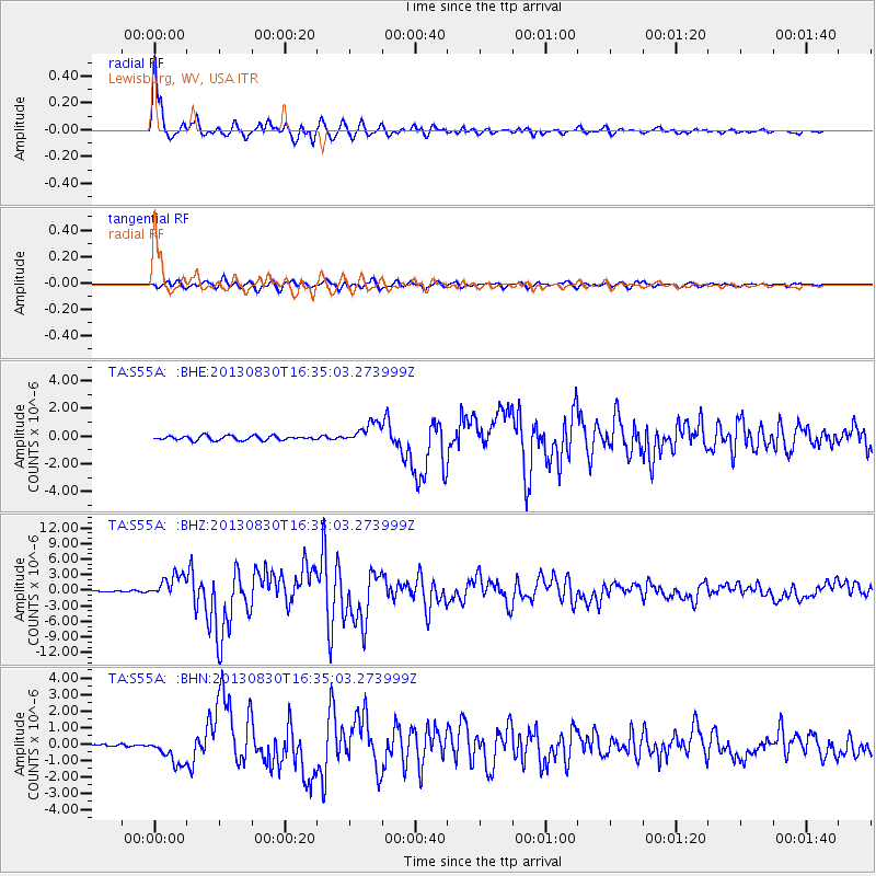
Earthquake location: Andreanof Islands, Aleutian Is.
Earthquake latitude/longitude: 51.5/-175.2
Earthquake time(UTC): 2013/08/30 (242) 16:25:02 GMT
Earthquake Depth: 29 km
Earthquake Magnitude: 7.0 MWW, 6.5 ML, 6.8 MI, 6.9 MWC, 6.9 MWB, 7.0 MWW, 7.0 MI, 7.0 MWC
Earthquake Catalog/Contributor: NEIC PDE/NEIC COMCAT
Network: TA USArray Transportable Network (new EarthScope stations)
Station: S55A Lewisburg, WV, USA
Lat/Lon: 37.77 N/80.50 W
Elevation: 647 m
Distance: 64.2 deg
Az: 61.322 deg
Baz: 316.253 deg
Ray Param: 0.05904505
Estimated Moho Depth: 36.75 km
Estimated Crust Vp/Vs: 2.08
Assumed Crust Vp: 6.159 km/s
Estimated Crust Vs: 2.964 km/s
Estimated Crust Poisson's Ratio: 0.35
Radial Match: 98.145615 %
Radial Bump: 400
Transverse Match: 91.324036 %
Transverse Bump: 400
SOD ConfigId: 626651
Insert Time: 2014-04-18 05:26:47.539 +0000
GWidth: 2.5
Max Bumps: 400
Tol: 0.001

Signal To Noise

ChannelStoNSTALTA
TA:S55A: :BHZ:20130830T16:35:03.273999Z13.523072.2443662E-61.6596573E-7
TA:S55A: :BHN:20130830T16:35:03.273999Z7.04594338.2035444E-71.1642933E-7
TA:S55A: :BHE:20130830T16:35:03.273999Z4.8270797.710425E-71.5973274E-7
Arrivals
Ps6.6 SECOND
PpPs18 SECOND
PsPs/PpSs24 SECOND