T49A Edmonton, KY, USA - Earthquake Result Viewer
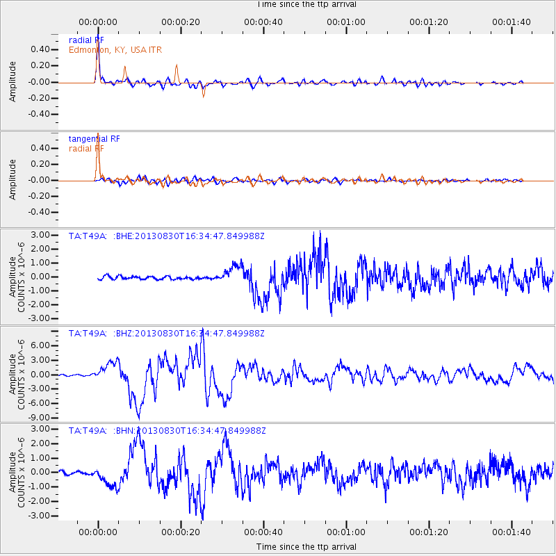
Earthquake location: Andreanof Islands, Aleutian Is.
Earthquake latitude/longitude: 51.5/-175.2
Earthquake time(UTC): 2013/08/30 (242) 16:25:02 GMT
Earthquake Depth: 29 km
Earthquake Magnitude: 7.0 MWW, 6.5 ML, 6.8 MI, 6.9 MWC, 6.9 MWB, 7.0 MWW, 7.0 MI, 7.0 MWC
Earthquake Catalog/Contributor: NEIC PDE/NEIC COMCAT
Network: TA USArray Transportable Network (new EarthScope stations)
Station: T49A Edmonton, KY, USA
Lat/Lon: 37.10 N/85.53 W
Elevation: 313 m
Distance: 61.9 deg
Az: 65.055 deg
Baz: 314.9 deg
Ray Param: 0.060568154
Estimated Moho Depth: 37.25 km
Estimated Crust Vp/Vs: 2.10
Assumed Crust Vp: 6.476 km/s
Estimated Crust Vs: 3.087 km/s
Estimated Crust Poisson's Ratio: 0.35
Radial Match: 97.361176 %
Radial Bump: 400
Transverse Match: 91.780655 %
Transverse Bump: 400
SOD ConfigId: 626651
Insert Time: 2014-04-18 05:27:16.147 +0000
GWidth: 2.5
Max Bumps: 400
Tol: 0.001

Signal To Noise

ChannelStoNSTALTA
TA:T49A: :BHZ:20130830T16:34:47.849988Z16.804732.0811945E-61.2384575E-7
TA:T49A: :BHN:20130830T16:34:47.849988Z4.9510467.0671786E-71.4274111E-7
TA:T49A: :BHE:20130830T16:34:47.849988Z6.2234486.621746E-71.0639996E-7
Arrivals
Ps6.6 SECOND
PpPs17 SECOND
PsPs/PpSs24 SECOND