T50A Nancy, KY, USA - Earthquake Result Viewer
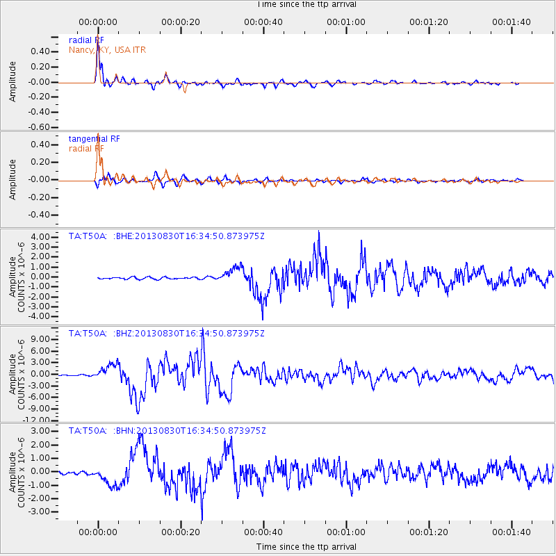
Earthquake location: Andreanof Islands, Aleutian Is.
Earthquake latitude/longitude: 51.5/-175.2
Earthquake time(UTC): 2013/08/30 (242) 16:25:02 GMT
Earthquake Depth: 29 km
Earthquake Magnitude: 7.0 MWW, 6.5 ML, 6.8 MI, 6.9 MWC, 6.9 MWB, 7.0 MWW, 7.0 MI, 7.0 MWC
Earthquake Catalog/Contributor: NEIC PDE/NEIC COMCAT
Network: TA USArray Transportable Network (new EarthScope stations)
Station: T50A Nancy, KY, USA
Lat/Lon: 37.02 N/84.84 W
Elevation: 302 m
Distance: 62.3 deg
Az: 64.677 deg
Baz: 315.14 deg
Ray Param: 0.06027014
Estimated Moho Depth: 37.0 km
Estimated Crust Vp/Vs: 2.00
Assumed Crust Vp: 6.476 km/s
Estimated Crust Vs: 3.246 km/s
Estimated Crust Poisson's Ratio: 0.33
Radial Match: 98.053055 %
Radial Bump: 385
Transverse Match: 90.92981 %
Transverse Bump: 400
SOD ConfigId: 626651
Insert Time: 2014-04-18 05:27:17.852 +0000
GWidth: 2.5
Max Bumps: 400
Tol: 0.001

Signal To Noise

ChannelStoNSTALTA
TA:T50A: :BHZ:20130830T16:34:50.873975Z20.1374822.176991E-61.0810642E-7
TA:T50A: :BHN:20130830T16:34:50.873975Z5.02454767.434397E-71.4796152E-7
TA:T50A: :BHE:20130830T16:34:50.873975Z8.4996228.277208E-79.738324E-8
Arrivals
Ps5.9 SECOND
PpPs16 SECOND
PsPs/PpSs22 SECOND