T52A Hallie, KY, USA - Earthquake Result Viewer
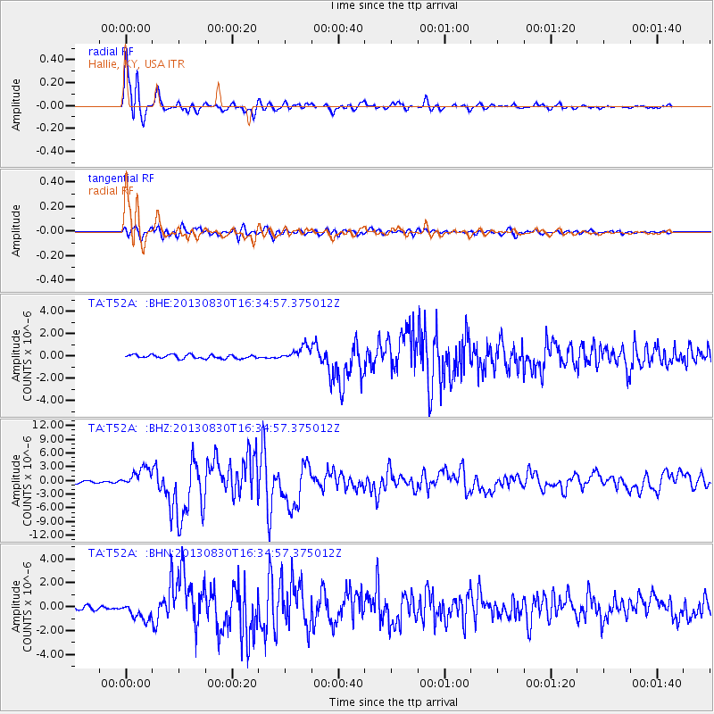
Earthquake location: Andreanof Islands, Aleutian Is.
Earthquake latitude/longitude: 51.5/-175.2
Earthquake time(UTC): 2013/08/30 (242) 16:25:02 GMT
Earthquake Depth: 29 km
Earthquake Magnitude: 7.0 MWW, 6.5 ML, 6.8 MI, 6.9 MWC, 6.9 MWB, 7.0 MWW, 7.0 MI, 7.0 MWC
Earthquake Catalog/Contributor: NEIC PDE/NEIC COMCAT
Network: TA USArray Transportable Network (new EarthScope stations)
Station: T52A Hallie, KY, USA
Lat/Lon: 37.11 N/82.99 W
Elevation: 436 m
Distance: 63.3 deg
Az: 63.421 deg
Baz: 315.678 deg
Ray Param: 0.059634283
Estimated Moho Depth: 13.25 km
Estimated Crust Vp/Vs: 1.96
Assumed Crust Vp: 6.476 km/s
Estimated Crust Vs: 3.3 km/s
Estimated Crust Poisson's Ratio: 0.32
Radial Match: 97.115135 %
Radial Bump: 400
Transverse Match: 86.41406 %
Transverse Bump: 400
SOD ConfigId: 626651
Insert Time: 2014-04-18 05:27:22.312 +0000
GWidth: 2.5
Max Bumps: 400
Tol: 0.001

Signal To Noise

ChannelStoNSTALTA
TA:T52A: :BHZ:20130830T16:34:57.375012Z9.712382.1349424E-62.198166E-7
TA:T52A: :BHN:20130830T16:34:57.375012Z4.87000277.900418E-71.6222614E-7
TA:T52A: :BHE:20130830T16:34:57.375012Z3.99966746.438957E-71.6098731E-7
Arrivals
Ps2.0 SECOND
PpPs5.8 SECOND
PsPs/PpSs7.9 SECOND