T54A Tazewell, VA, USA - Earthquake Result Viewer
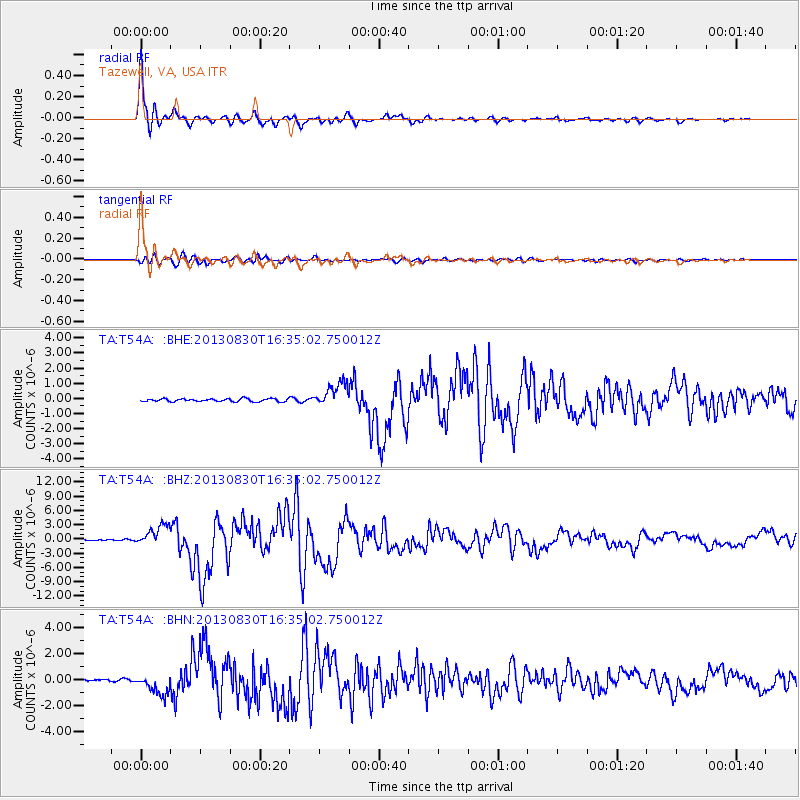
Earthquake location: Andreanof Islands, Aleutian Is.
Earthquake latitude/longitude: 51.5/-175.2
Earthquake time(UTC): 2013/08/30 (242) 16:25:02 GMT
Earthquake Depth: 29 km
Earthquake Magnitude: 7.0 MWW, 6.5 ML, 6.8 MI, 6.9 MWC, 6.9 MWB, 7.0 MWW, 7.0 MI, 7.0 MWC
Earthquake Catalog/Contributor: NEIC PDE/NEIC COMCAT
Network: TA USArray Transportable Network (new EarthScope stations)
Station: T54A Tazewell, VA, USA
Lat/Lon: 37.06 N/81.58 W
Elevation: 852 m
Distance: 64.1 deg
Az: 62.555 deg
Baz: 316.14 deg
Ray Param: 0.05909792
Estimated Moho Depth: 12.5 km
Estimated Crust Vp/Vs: 2.10
Assumed Crust Vp: 6.159 km/s
Estimated Crust Vs: 2.936 km/s
Estimated Crust Poisson's Ratio: 0.35
Radial Match: 98.17976 %
Radial Bump: 380
Transverse Match: 92.30112 %
Transverse Bump: 400
SOD ConfigId: 626651
Insert Time: 2014-04-18 05:27:27.074 +0000
GWidth: 2.5
Max Bumps: 400
Tol: 0.001

Signal To Noise

ChannelStoNSTALTA
TA:T54A: :BHZ:20130830T16:35:02.750012Z16.2501662.1758924E-61.3389969E-7
TA:T54A: :BHN:20130830T16:35:02.750012Z6.38944057.8120553E-71.2226509E-7
TA:T54A: :BHE:20130830T16:35:02.750012Z8.1791497.9365304E-79.70337E-8
Arrivals
Ps2.3 SECOND
PpPs6.1 SECOND
PsPs/PpSs8.4 SECOND