T56A Rocky Mt, VA, USA - Earthquake Result Viewer
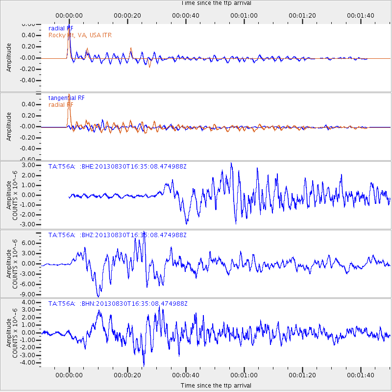
Earthquake location: Andreanof Islands, Aleutian Is.
Earthquake latitude/longitude: 51.5/-175.2
Earthquake time(UTC): 2013/08/30 (242) 16:25:02 GMT
Earthquake Depth: 29 km
Earthquake Magnitude: 7.0 MWW, 6.5 ML, 6.8 MI, 6.9 MWC, 6.9 MWB, 7.0 MWW, 7.0 MI, 7.0 MWC
Earthquake Catalog/Contributor: NEIC PDE/NEIC COMCAT
Network: TA USArray Transportable Network (new EarthScope stations)
Station: T56A Rocky Mt, VA, USA
Lat/Lon: 37.03 N/80.03 W
Elevation: 387 m
Distance: 65.0 deg
Az: 61.588 deg
Baz: 316.651 deg
Ray Param: 0.05853234
Estimated Moho Depth: 20.5 km
Estimated Crust Vp/Vs: 1.74
Assumed Crust Vp: 6.159 km/s
Estimated Crust Vs: 3.534 km/s
Estimated Crust Poisson's Ratio: 0.25
Radial Match: 96.84252 %
Radial Bump: 400
Transverse Match: 87.54028 %
Transverse Bump: 400
SOD ConfigId: 626651
Insert Time: 2014-04-18 05:27:32.130 +0000
GWidth: 2.5
Max Bumps: 400
Tol: 0.001

Signal To Noise

ChannelStoNSTALTA
TA:T56A: :BHZ:20130830T16:35:08.474988Z9.8439391.9595673E-61.9906332E-7
TA:T56A: :BHN:20130830T16:35:08.474988Z4.57624346.414986E-71.4018019E-7
TA:T56A: :BHE:20130830T16:35:08.474988Z5.92747266.527582E-71.10124205E-7
Arrivals
Ps2.6 SECOND
PpPs8.8 SECOND
PsPs/PpSs11 SECOND