T57A Hurt, VA, USA - Earthquake Result Viewer
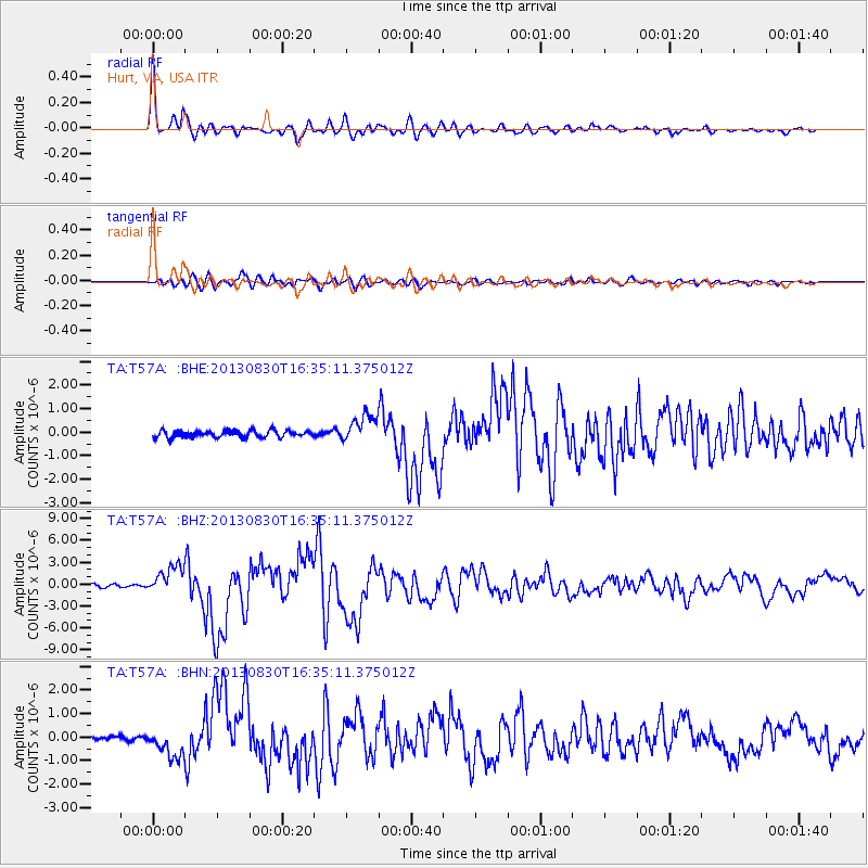
Earthquake location: Andreanof Islands, Aleutian Is.
Earthquake latitude/longitude: 51.5/-175.2
Earthquake time(UTC): 2013/08/30 (242) 16:25:02 GMT
Earthquake Depth: 29 km
Earthquake Magnitude: 7.0 MWW, 6.5 ML, 6.8 MI, 6.9 MWC, 6.9 MWB, 7.0 MWW, 7.0 MI, 7.0 MWC
Earthquake Catalog/Contributor: NEIC PDE/NEIC COMCAT
Network: TA USArray Transportable Network (new EarthScope stations)
Station: T57A Hurt, VA, USA
Lat/Lon: 37.00 N/79.25 W
Elevation: 230 m
Distance: 65.4 deg
Az: 61.111 deg
Baz: 316.917 deg
Ray Param: 0.058238212
Estimated Moho Depth: 64.75 km
Estimated Crust Vp/Vs: 2.07
Assumed Crust Vp: 6.419 km/s
Estimated Crust Vs: 3.109 km/s
Estimated Crust Poisson's Ratio: 0.35
Radial Match: 97.221466 %
Radial Bump: 388
Transverse Match: 89.1441 %
Transverse Bump: 400
SOD ConfigId: 626651
Insert Time: 2014-04-18 05:27:34.879 +0000
GWidth: 2.5
Max Bumps: 400
Tol: 0.001

Signal To Noise

ChannelStoNSTALTA
TA:T57A: :BHZ:20130830T16:35:11.375012Z10.0716081.9543493E-61.9404543E-7
TA:T57A: :BHN:20130830T16:35:11.375012Z3.8155725.643252E-71.4790054E-7
TA:T57A: :BHE:20130830T16:35:11.375012Z3.90845925.761368E-71.4740766E-7
Arrivals
Ps11 SECOND
PpPs30 SECOND
PsPs/PpSs41 SECOND