TPFO Pinon Flats, CA, USA - Earthquake Result Viewer
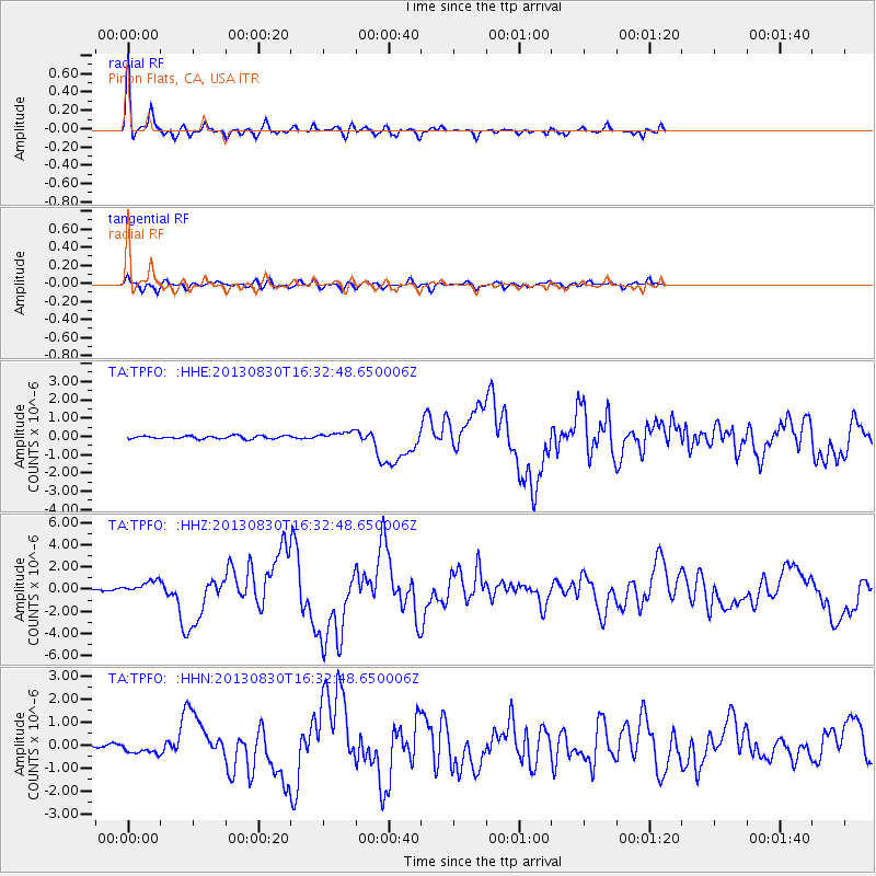
Earthquake location: Andreanof Islands, Aleutian Is.
Earthquake latitude/longitude: 51.5/-175.2
Earthquake time(UTC): 2013/08/30 (242) 16:25:02 GMT
Earthquake Depth: 29 km
Earthquake Magnitude: 7.0 MWW, 6.5 ML, 6.8 MI, 6.9 MWC, 6.9 MWB, 7.0 MWW, 7.0 MI, 7.0 MWC
Earthquake Catalog/Contributor: NEIC PDE/NEIC COMCAT
Network: TA USArray Transportable Network (new EarthScope stations)
Station: TPFO Pinon Flats, CA, USA
Lat/Lon: 33.61 N/116.45 W
Elevation: 1275 m
Distance: 45.5 deg
Az: 89.502 deg
Baz: 311.553 deg
Ray Param: 0.07115765
Estimated Moho Depth: 28.75 km
Estimated Crust Vp/Vs: 1.74
Assumed Crust Vp: 6.264 km/s
Estimated Crust Vs: 3.6 km/s
Estimated Crust Poisson's Ratio: 0.25
Radial Match: 95.07311 %
Radial Bump: 354
Transverse Match: 81.12139 %
Transverse Bump: 400
SOD ConfigId: 626651
Insert Time: 2014-04-18 05:27:46.624 +0000
GWidth: 2.5
Max Bumps: 400
Tol: 0.001

Signal To Noise

ChannelStoNSTALTA
TA:TPFO: :HHZ:20130830T16:32:48.650006Z5.94739536.1887465E-71.040581E-7
TA:TPFO: :HHN:20130830T16:32:48.650006Z3.25197462.5463552E-77.830182E-8
TA:TPFO: :HHE:20130830T16:32:48.650006Z2.80987242.2802203E-78.115031E-8
Arrivals
Ps3.6 SECOND
PpPs12 SECOND
PsPs/PpSs15 SECOND