U58A Oxford, NC, USA - Earthquake Result Viewer
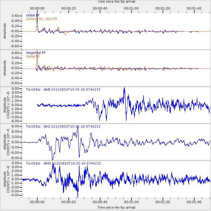
Earthquake location: Andreanof Islands, Aleutian Is.
Earthquake latitude/longitude: 51.5/-175.2
Earthquake time(UTC): 2013/08/30 (242) 16:25:02 GMT
Earthquake Depth: 29 km
Earthquake Magnitude: 7.0 MWW, 6.5 ML, 6.8 MI, 6.9 MWC, 6.9 MWB, 7.0 MWW, 7.0 MI, 7.0 MWC
Earthquake Catalog/Contributor: NEIC PDE/NEIC COMCAT
Network: TA USArray Transportable Network (new EarthScope stations)
Station: U58A Oxford, NC, USA
Lat/Lon: 36.39 N/78.55 W
Elevation: 169 m
Distance: 66.3 deg
Az: 61.106 deg
Baz: 317.334 deg
Ray Param: 0.057696525
Estimated Moho Depth: 26.25 km
Estimated Crust Vp/Vs: 2.10
Assumed Crust Vp: 6.419 km/s
Estimated Crust Vs: 3.06 km/s
Estimated Crust Poisson's Ratio: 0.35
Radial Match: 97.084625 %
Radial Bump: 400
Transverse Match: 83.81566 %
Transverse Bump: 400
SOD ConfigId: 626651
Insert Time: 2014-04-18 05:28:21.895 +0000
GWidth: 2.5
Max Bumps: 400
Tol: 0.001

Signal To Noise

ChannelStoNSTALTA
TA:U58A: :BHZ:20130830T16:35:16.674023Z19.0671061.9718138E-61.0341443E-7
TA:U58A: :BHN:20130830T16:35:16.674023Z5.71805578.018001E-71.4022251E-7
TA:U58A: :BHE:20130830T16:35:16.674023Z4.78895047.0509833E-71.4723442E-7
Arrivals
Ps4.6 SECOND
PpPs12 SECOND
PsPs/PpSs17 SECOND