You are here: Home > Network List > X812 - Deep Structure of Three Continental Sutures in Eastern North America Stations List
> Station QM20 Hay Lake, Maine, USA > Earthquake Result Viewer
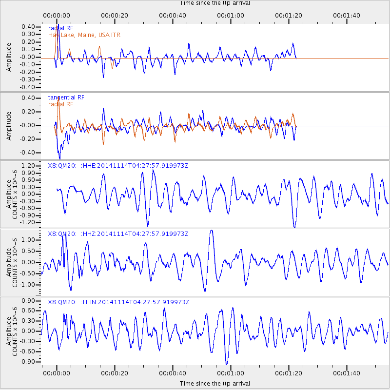
QM20 Hay Lake, Maine, USA - Earthquake Result Viewer
*The percent match for this event was below the threshold and hence no stack was calculated.
| Earthquake location: |
Kuril Islands |
| Earthquake latitude/longitude: |
45.2/150.9 |
| Earthquake time(UTC): |
2014/11/14 (318) 04:16:07 GMT |
| Earthquake Depth: |
18 km |
| Earthquake Magnitude: |
5.7 MB |
| Earthquake Catalog/Contributor: |
NEIC PDE/NEIC COMCAT |
|
| Network: |
X8 Deep Structure of Three Continental Sutures in Eastern North America |
| Station: |
QM20 Hay Lake, Maine, USA |
| Lat/Lon: |
46.13 N/68.72 W |
| Elevation: |
207 m |
|
| Distance: |
82.5 deg |
| Az: |
26.589 deg |
| Baz: |
332.942 deg |
| Ray Param: |
$rayparam |
*The percent match for this event was below the threshold and hence was not used in the summary stack. |
|
| Radial Match: |
54.07431 % |
| Radial Bump: |
372 |
| Transverse Match: |
65.85392 % |
| Transverse Bump: |
400 |
| SOD ConfigId: |
3390531 |
| Insert Time: |
2019-04-14 23:48:59.828 +0000 |
| GWidth: |
2.5 |
| Max Bumps: |
400 |
| Tol: |
0.001 |
|
Signal To Noise
| Channel | StoN | STA | LTA |
| X8:QM20: :HHZ:20141114T04:27:57.919973Z | 1.7618679 | 6.5110015E-7 | 3.6955106E-7 |
| X8:QM20: :HHN:20141114T04:27:57.919973Z | 1.1115727 | 2.9607932E-7 | 2.6636076E-7 |
| X8:QM20: :HHE:20141114T04:27:57.919973Z | 2.3386364 | 7.572164E-7 | 3.2378546E-7 |
| Arrivals |
| Ps | |
| PpPs | |
| PsPs/PpSs | |


