V60A Jim Taylor Road, Stokes, NC, USA - Earthquake Result Viewer
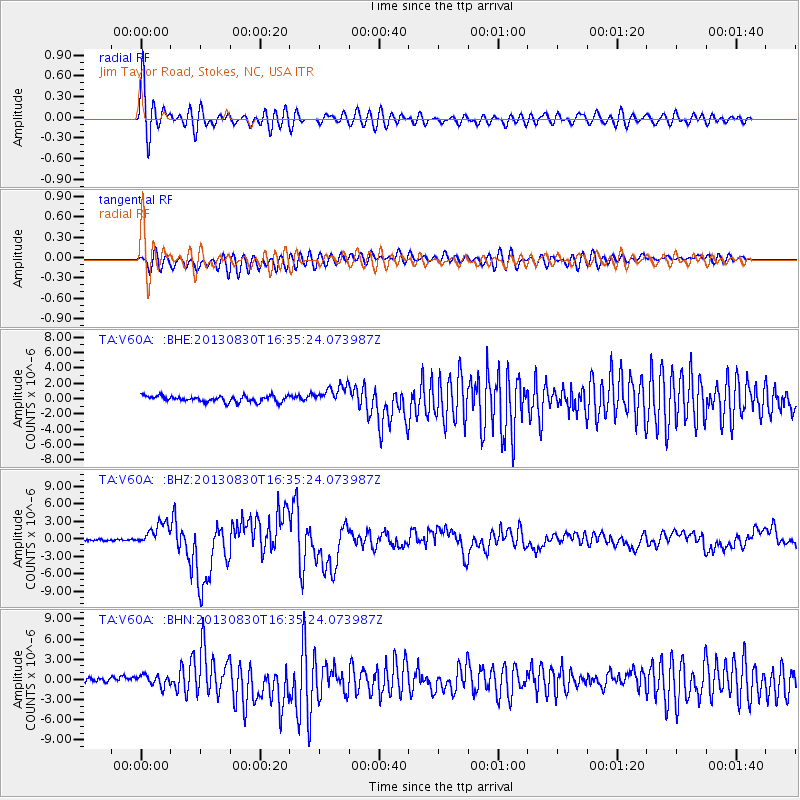
Earthquake location: Andreanof Islands, Aleutian Is.
Earthquake latitude/longitude: 51.5/-175.2
Earthquake time(UTC): 2013/08/30 (242) 16:25:02 GMT
Earthquake Depth: 29 km
Earthquake Magnitude: 7.0 MWW, 6.5 ML, 6.8 MI, 6.9 MWC, 6.9 MWB, 7.0 MWW, 7.0 MI, 7.0 MWC
Earthquake Catalog/Contributor: NEIC PDE/NEIC COMCAT
Network: TA USArray Transportable Network (new EarthScope stations)
Station: V60A Jim Taylor Road, Stokes, NC, USA
Lat/Lon: 35.76 N/77.26 W
Elevation: 8.0 m
Distance: 67.4 deg
Az: 60.729 deg
Baz: 317.94 deg
Ray Param: 0.05692855
Estimated Moho Depth: 22.5 km
Estimated Crust Vp/Vs: 2.10
Assumed Crust Vp: 6.565 km/s
Estimated Crust Vs: 3.133 km/s
Estimated Crust Poisson's Ratio: 0.35
Radial Match: 91.63945 %
Radial Bump: 400
Transverse Match: 72.67294 %
Transverse Bump: 400
SOD ConfigId: 626651
Insert Time: 2014-04-18 05:29:00.682 +0000
GWidth: 2.5
Max Bumps: 400
Tol: 0.001

Signal To Noise

ChannelStoNSTALTA
TA:V60A: :BHZ:20130830T16:35:24.073987Z12.1115731.9780007E-61.6331492E-7
TA:V60A: :BHN:20130830T16:35:24.073987Z1.83203898.203811E-74.4779677E-7
TA:V60A: :BHE:20130830T16:35:24.073987Z3.1554711.2453972E-63.9467872E-7
Arrivals
Ps3.9 SECOND
PpPs10 SECOND
PsPs/PpSs14 SECOND