W52A Murphy, NC, USA - Earthquake Result Viewer
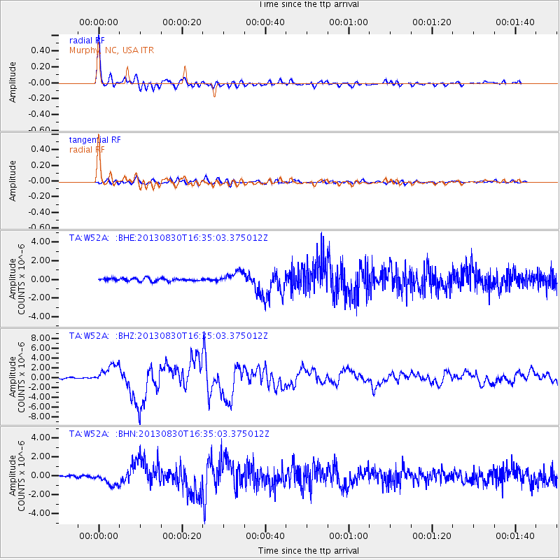
Earthquake location: Andreanof Islands, Aleutian Is.
Earthquake latitude/longitude: 51.5/-175.2
Earthquake time(UTC): 2013/08/30 (242) 16:25:02 GMT
Earthquake Depth: 29 km
Earthquake Magnitude: 7.0 MWW, 6.5 ML, 6.8 MI, 6.9 MWC, 6.9 MWB, 7.0 MWW, 7.0 MI, 7.0 MWC
Earthquake Catalog/Contributor: NEIC PDE/NEIC COMCAT
Network: TA USArray Transportable Network (new EarthScope stations)
Station: W52A Murphy, NC, USA
Lat/Lon: 35.09 N/83.93 W
Elevation: 519 m
Distance: 64.2 deg
Az: 65.593 deg
Baz: 316.086 deg
Ray Param: 0.0590356
Estimated Moho Depth: 20.75 km
Estimated Crust Vp/Vs: 1.82
Assumed Crust Vp: 6.35 km/s
Estimated Crust Vs: 3.494 km/s
Estimated Crust Poisson's Ratio: 0.28
Radial Match: 96.62515 %
Radial Bump: 400
Transverse Match: 84.13761 %
Transverse Bump: 400
SOD ConfigId: 626651
Insert Time: 2014-04-18 05:29:21.716 +0000
GWidth: 2.5
Max Bumps: 400
Tol: 0.001

Signal To Noise

ChannelStoNSTALTA
TA:W52A: :BHZ:20130830T16:35:03.375012Z13.353362.0000966E-61.4978228E-7
TA:W52A: :BHN:20130830T16:35:03.375012Z4.67996366.720107E-71.4359314E-7
TA:W52A: :BHE:20130830T16:35:03.375012Z4.18458186.473753E-71.547049E-7
Arrivals
Ps2.8 SECOND
PpPs8.8 SECOND
PsPs/PpSs12 SECOND