W54A Cherokee Point, Campobello, SC, USA - Earthquake Result Viewer
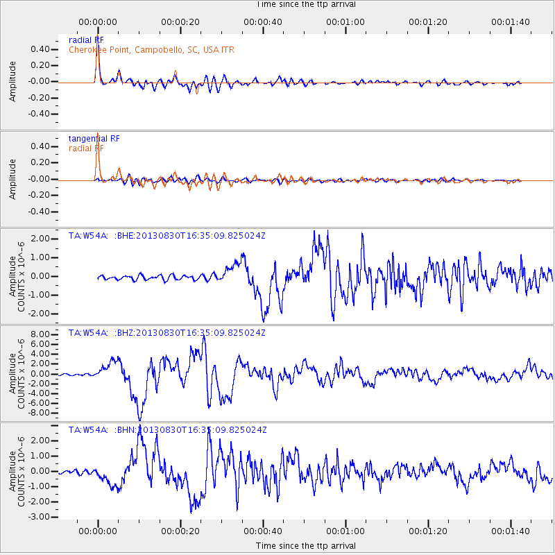
Earthquake location: Andreanof Islands, Aleutian Is.
Earthquake latitude/longitude: 51.5/-175.2
Earthquake time(UTC): 2013/08/30 (242) 16:25:02 GMT
Earthquake Depth: 29 km
Earthquake Magnitude: 7.0 MWW, 6.5 ML, 6.8 MI, 6.9 MWC, 6.9 MWB, 7.0 MWW, 7.0 MI, 7.0 MWC
Earthquake Catalog/Contributor: NEIC PDE/NEIC COMCAT
Network: TA USArray Transportable Network (new EarthScope stations)
Station: W54A Cherokee Point, Campobello, SC, USA
Lat/Lon: 35.09 N/82.19 W
Elevation: 272 m
Distance: 65.2 deg
Az: 64.456 deg
Baz: 316.597 deg
Ray Param: 0.058394477
Estimated Moho Depth: 46.25 km
Estimated Crust Vp/Vs: 1.69
Assumed Crust Vp: 6.35 km/s
Estimated Crust Vs: 3.769 km/s
Estimated Crust Poisson's Ratio: 0.23
Radial Match: 96.92649 %
Radial Bump: 400
Transverse Match: 81.16603 %
Transverse Bump: 400
SOD ConfigId: 626651
Insert Time: 2014-04-18 05:29:26.717 +0000
GWidth: 2.5
Max Bumps: 400
Tol: 0.001

Signal To Noise

ChannelStoNSTALTA
TA:W54A: :BHZ:20130830T16:35:09.825024Z15.4572591.9971835E-61.2920682E-7
TA:W54A: :BHN:20130830T16:35:09.825024Z4.792316.865199E-71.4325448E-7
TA:W54A: :BHE:20130830T16:35:09.825024Z5.1202765.616357E-71.0968857E-7
Arrivals
Ps5.2 SECOND
PpPs19 SECOND
PsPs/PpSs24 SECOND