W61A Ground Anchor Farm, New Bern, NC, USA - Earthquake Result Viewer
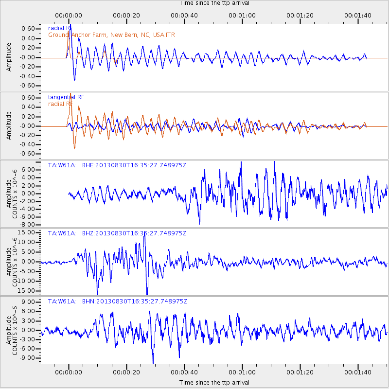
Earthquake location: Andreanof Islands, Aleutian Is.
Earthquake latitude/longitude: 51.5/-175.2
Earthquake time(UTC): 2013/08/30 (242) 16:25:02 GMT
Earthquake Depth: 29 km
Earthquake Magnitude: 7.0 MWW, 6.5 ML, 6.8 MI, 6.9 MWC, 6.9 MWB, 7.0 MWW, 7.0 MI, 7.0 MWC
Earthquake Catalog/Contributor: NEIC PDE/NEIC COMCAT
Network: TA USArray Transportable Network (new EarthScope stations)
Station: W61A Ground Anchor Farm, New Bern, NC, USA
Lat/Lon: 35.18 N/76.99 W
Elevation: 6.0 m
Distance: 68.0 deg
Az: 60.974 deg
Baz: 318.19 deg
Ray Param: 0.05654781
Estimated Moho Depth: 40.0 km
Estimated Crust Vp/Vs: 1.61
Assumed Crust Vp: 6.565 km/s
Estimated Crust Vs: 4.09 km/s
Estimated Crust Poisson's Ratio: 0.18
Radial Match: 92.58943 %
Radial Bump: 400
Transverse Match: 76.16164 %
Transverse Bump: 400
SOD ConfigId: 626651
Insert Time: 2014-04-18 05:29:41.218 +0000
GWidth: 2.5
Max Bumps: 400
Tol: 0.001

Signal To Noise

ChannelStoNSTALTA
TA:W61A: :BHZ:20130830T16:35:27.748975Z7.07722762.2897234E-63.2353395E-7
TA:W61A: :BHN:20130830T16:35:27.748975Z1.4971039.0216014E-76.0260396E-7
TA:W61A: :BHE:20130830T16:35:27.748975Z0.82338788.1384155E-79.884061E-7
Arrivals
Ps3.9 SECOND
PpPs15 SECOND
PsPs/PpSs19 SECOND