
Y51A Rockmart, GA, USA - Earthquake Result Viewer
| ||||||||||||||||||
| ||||||||||||||||||
| ||||||||||||||||||
|
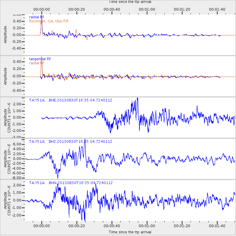
Signal To Noise
| Channel | StoN | STA | LTA |
| TA:Y51A: :BHZ:20130830T16:35:04.724011Z | 18.775091 | 1.8298516E-6 | 9.7461665E-8 |
| TA:Y51A: :BHN:20130830T16:35:04.724011Z | 6.849649 | 6.177826E-7 | 9.019186E-8 |
| TA:Y51A: :BHE:20130830T16:35:04.724011Z | 7.301812 | 5.582586E-7 | 7.6454796E-8 |
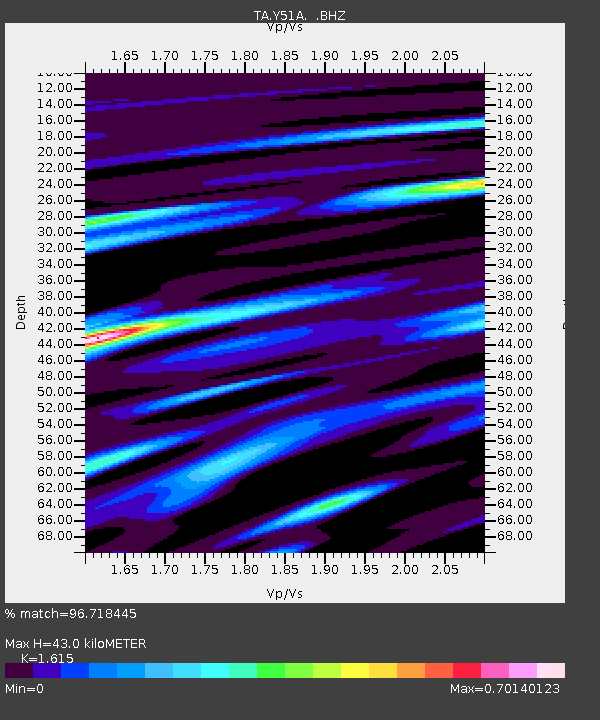
| Arrivals | |
| Ps | 4.1 SECOND |
| PpPs | 16 SECOND |
| PsPs/PpSs | 20 SECOND |

