Y52A Lilburn, GA, USA - Earthquake Result Viewer
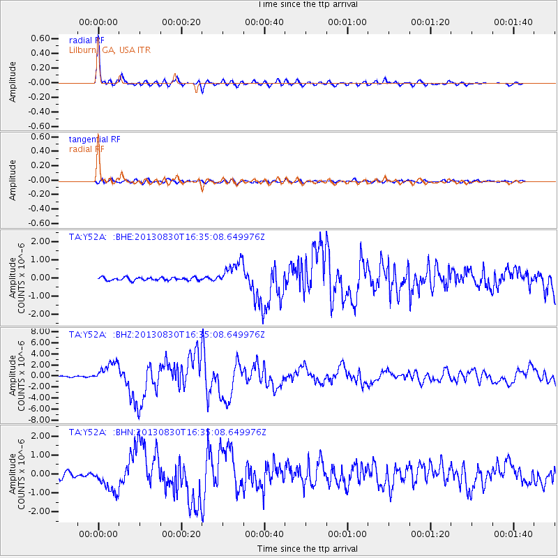
Earthquake location: Andreanof Islands, Aleutian Is.
Earthquake latitude/longitude: 51.5/-175.2
Earthquake time(UTC): 2013/08/30 (242) 16:25:02 GMT
Earthquake Depth: 29 km
Earthquake Magnitude: 7.0 MWW, 6.5 ML, 6.8 MI, 6.9 MWC, 6.9 MWB, 7.0 MWW, 7.0 MI, 7.0 MWC
Earthquake Catalog/Contributor: NEIC PDE/NEIC COMCAT
Network: TA USArray Transportable Network (new EarthScope stations)
Station: Y52A Lilburn, GA, USA
Lat/Lon: 33.86 N/84.06 W
Elevation: 286 m
Distance: 65.0 deg
Az: 66.62 deg
Baz: 316.451 deg
Ray Param: 0.05851424
Estimated Moho Depth: 49.0 km
Estimated Crust Vp/Vs: 1.77
Assumed Crust Vp: 6.719 km/s
Estimated Crust Vs: 3.802 km/s
Estimated Crust Poisson's Ratio: 0.26
Radial Match: 97.80118 %
Radial Bump: 342
Transverse Match: 80.567444 %
Transverse Bump: 400
SOD ConfigId: 626651
Insert Time: 2014-04-18 05:30:24.528 +0000
GWidth: 2.5
Max Bumps: 400
Tol: 0.001

Signal To Noise

ChannelStoNSTALTA
TA:Y52A: :BHZ:20130830T16:35:08.649976Z12.8505471.917186E-61.49191E-7
TA:Y52A: :BHN:20130830T16:35:08.649976Z6.0915897.079385E-71.16215745E-7
TA:Y52A: :BHE:20130830T16:35:08.649976Z8.7308257.072337E-78.100422E-8
Arrivals
Ps5.9 SECOND
PpPs19 SECOND
PsPs/PpSs25 SECOND