Y53A Monroe, GA, USA - Earthquake Result Viewer
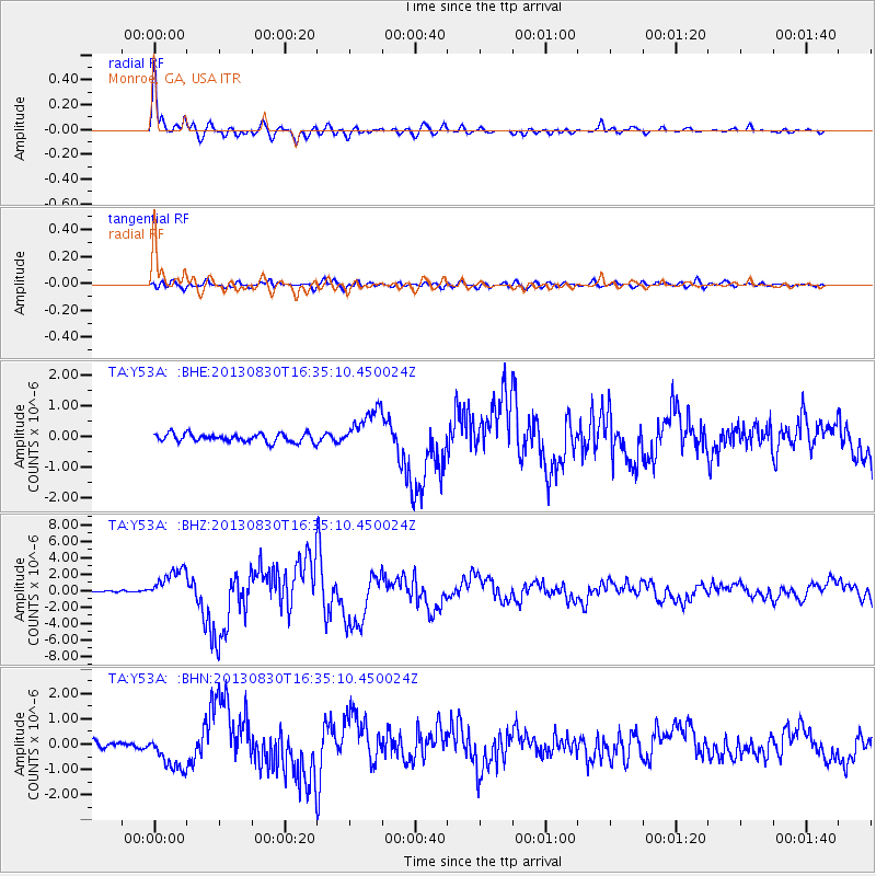
Earthquake location: Andreanof Islands, Aleutian Is.
Earthquake latitude/longitude: 51.5/-175.2
Earthquake time(UTC): 2013/08/30 (242) 16:25:02 GMT
Earthquake Depth: 29 km
Earthquake Magnitude: 7.0 MWW, 6.5 ML, 6.8 MI, 6.9 MWC, 6.9 MWB, 7.0 MWW, 7.0 MI, 7.0 MWC
Earthquake Catalog/Contributor: NEIC PDE/NEIC COMCAT
Network: TA USArray Transportable Network (new EarthScope stations)
Station: Y53A Monroe, GA, USA
Lat/Lon: 33.86 N/83.58 W
Elevation: 234 m
Distance: 65.3 deg
Az: 66.308 deg
Baz: 316.585 deg
Ray Param: 0.058330175
Estimated Moho Depth: 43.25 km
Estimated Crust Vp/Vs: 1.70
Assumed Crust Vp: 6.565 km/s
Estimated Crust Vs: 3.861 km/s
Estimated Crust Poisson's Ratio: 0.24
Radial Match: 97.92475 %
Radial Bump: 400
Transverse Match: 79.36703 %
Transverse Bump: 400
SOD ConfigId: 626651
Insert Time: 2014-04-18 05:30:28.756 +0000
GWidth: 2.5
Max Bumps: 400
Tol: 0.001

Signal To Noise

ChannelStoNSTALTA
TA:Y53A: :BHZ:20130830T16:35:10.450024Z15.636821.9389695E-61.2400025E-7
TA:Y53A: :BHN:20130830T16:35:10.450024Z6.83305077.270216E-71.06397806E-7
TA:Y53A: :BHE:20130830T16:35:10.450024Z4.7876956.5566144E-71.369472E-7
Arrivals
Ps4.8 SECOND
PpPs17 SECOND
PsPs/PpSs22 SECOND