Y55A Saluda, SC, USA - Earthquake Result Viewer
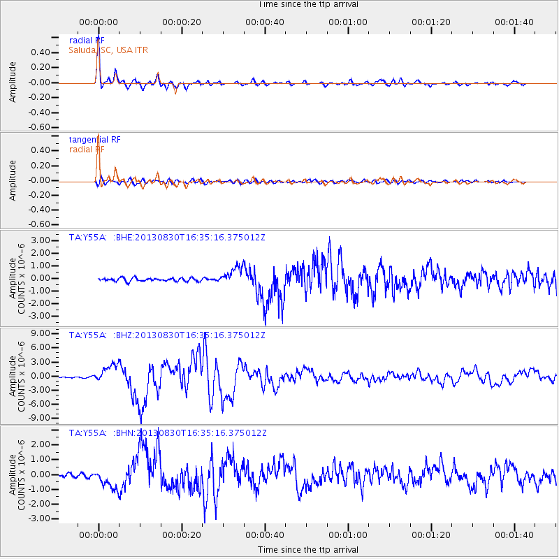
Earthquake location: Andreanof Islands, Aleutian Is.
Earthquake latitude/longitude: 51.5/-175.2
Earthquake time(UTC): 2013/08/30 (242) 16:25:02 GMT
Earthquake Depth: 29 km
Earthquake Magnitude: 7.0 MWW, 6.5 ML, 6.8 MI, 6.9 MWC, 6.9 MWB, 7.0 MWW, 7.0 MI, 7.0 MWC
Earthquake Catalog/Contributor: NEIC PDE/NEIC COMCAT
Network: TA USArray Transportable Network (new EarthScope stations)
Station: Y55A Saluda, SC, USA
Lat/Lon: 33.94 N/81.86 W
Elevation: 164 m
Distance: 66.2 deg
Az: 65.099 deg
Baz: 317.046 deg
Ray Param: 0.057725668
Estimated Moho Depth: 29.25 km
Estimated Crust Vp/Vs: 1.89
Assumed Crust Vp: 6.565 km/s
Estimated Crust Vs: 3.473 km/s
Estimated Crust Poisson's Ratio: 0.31
Radial Match: 97.28237 %
Radial Bump: 387
Transverse Match: 80.53378 %
Transverse Bump: 400
SOD ConfigId: 626651
Insert Time: 2014-04-18 05:30:33.356 +0000
GWidth: 2.5
Max Bumps: 400
Tol: 0.001

Signal To Noise

ChannelStoNSTALTA
TA:Y55A: :BHZ:20130830T16:35:16.375012Z22.4472622.0405475E-69.090407E-8
TA:Y55A: :BHN:20130830T16:35:16.375012Z4.42293646.7148153E-71.5181804E-7
TA:Y55A: :BHE:20130830T16:35:16.375012Z5.9506767.312942E-71.2289264E-7
Arrivals
Ps4.1 SECOND
PpPs12 SECOND
PsPs/PpSs17 SECOND