Y57A Sumter, SC, USA - Earthquake Result Viewer
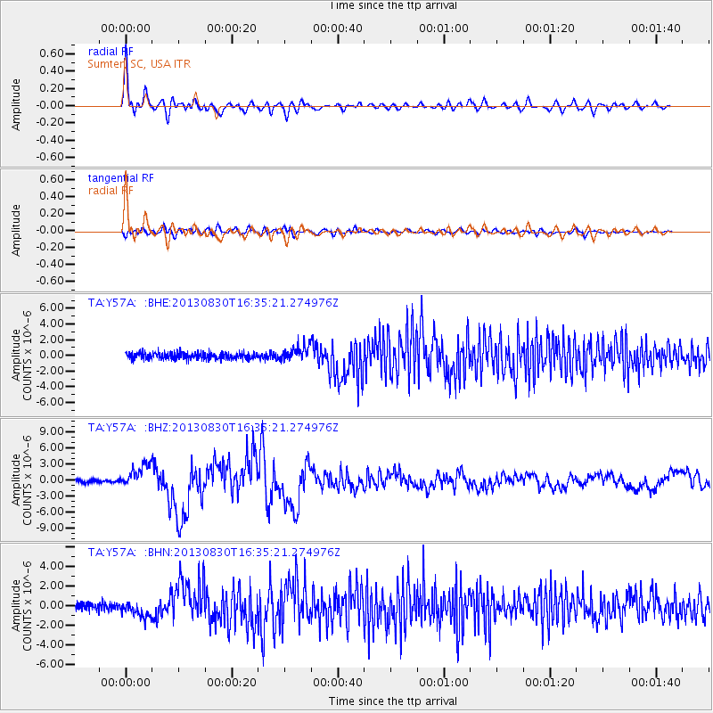
Earthquake location: Andreanof Islands, Aleutian Is.
Earthquake latitude/longitude: 51.5/-175.2
Earthquake time(UTC): 2013/08/30 (242) 16:25:02 GMT
Earthquake Depth: 29 km
Earthquake Magnitude: 7.0 MWW, 6.5 ML, 6.8 MI, 6.9 MWC, 6.9 MWB, 7.0 MWW, 7.0 MI, 7.0 MWC
Earthquake Catalog/Contributor: NEIC PDE/NEIC COMCAT
Network: TA USArray Transportable Network (new EarthScope stations)
Station: Y57A Sumter, SC, USA
Lat/Lon: 34.02 N/80.39 W
Elevation: 56 m
Distance: 67.0 deg
Az: 64.065 deg
Baz: 317.451 deg
Ray Param: 0.057216257
Estimated Moho Depth: 28.0 km
Estimated Crust Vp/Vs: 1.83
Assumed Crust Vp: 6.419 km/s
Estimated Crust Vs: 3.517 km/s
Estimated Crust Poisson's Ratio: 0.29
Radial Match: 93.45061 %
Radial Bump: 400
Transverse Match: 74.564026 %
Transverse Bump: 400
SOD ConfigId: 626651
Insert Time: 2014-04-18 05:30:38.298 +0000
GWidth: 2.5
Max Bumps: 400
Tol: 0.001

Signal To Noise

ChannelStoNSTALTA
TA:Y57A: :BHZ:20130830T16:35:21.274976Z7.8706072.2325512E-62.8365682E-7
TA:Y57A: :BHN:20130830T16:35:21.274976Z2.17247928.0999774E-73.728449E-7
TA:Y57A: :BHE:20130830T16:35:21.274976Z2.18474039.1092903E-74.169507E-7
Arrivals
Ps3.7 SECOND
PpPs12 SECOND
PsPs/PpSs16 SECOND