
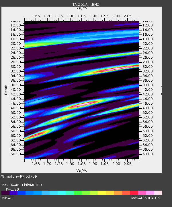
Z51A Franklin, GA, USA - Earthquake Result Viewer
| ||||||||||||||||||
| ||||||||||||||||||
| ||||||||||||||||||
|
Signal To Noise
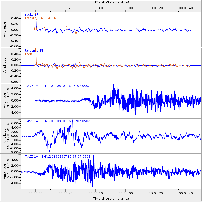
| Channel | StoN | STA | LTA |
| TA:Z51A: :BHZ:20130830T16:35:07.050Z | 19.418442 | 1.7957069E-6 | 9.247431E-8 |
| TA:Z51A: :BHN:20130830T16:35:07.050Z | 6.1856627 | 7.529786E-7 | 1.2172967E-7 |
| TA:Z51A: :BHE:20130830T16:35:07.050Z | 4.570285 | 5.145345E-7 | 1.125826E-7 |
| Arrivals | |
| Ps | 6.2 SECOND |
| PpPs | 19 SECOND |
| PsPs/PpSs | 25 SECOND |

