AGMN Agassiz National Wildlife Refuge, Minnesota, USA - Earthquake Result Viewer
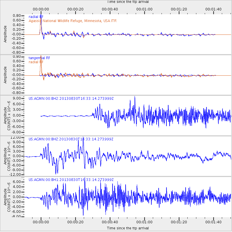
Earthquake location: Andreanof Islands, Aleutian Is.
Earthquake latitude/longitude: 51.5/-175.2
Earthquake time(UTC): 2013/08/30 (242) 16:25:02 GMT
Earthquake Depth: 29 km
Earthquake Magnitude: 7.0 MWW, 6.5 ML, 6.8 MI, 6.9 MWC, 6.9 MWB, 7.0 MWW, 7.0 MI, 7.0 MWC
Earthquake Catalog/Contributor: NEIC PDE/NEIC COMCAT
Network: US United States National Seismic Network
Station: AGMN Agassiz National Wildlife Refuge, Minnesota, USA
Lat/Lon: 48.30 N/95.86 W
Elevation: 351 m
Distance: 48.8 deg
Az: 60.672 deg
Baz: 305.367 deg
Ray Param: 0.069046035
Estimated Moho Depth: 37.0 km
Estimated Crust Vp/Vs: 1.64
Assumed Crust Vp: 6.419 km/s
Estimated Crust Vs: 3.908 km/s
Estimated Crust Poisson's Ratio: 0.21
Radial Match: 96.31027 %
Radial Bump: 397
Transverse Match: 87.71646 %
Transverse Bump: 400
SOD ConfigId: 626651
Insert Time: 2014-04-18 05:31:48.205 +0000
GWidth: 2.5
Max Bumps: 400
Tol: 0.001

Signal To Noise

ChannelStoNSTALTA
US:AGMN:00:BHZ:20130830T16:33:14.273999Z21.8752653.3776616E-61.5440551E-7
US:AGMN:00:BH1:20130830T16:33:14.273999Z9.4562041.6365983E-61.7307137E-7
US:AGMN:00:BH2:20130830T16:33:14.273999Z16.7000182.1958315E-61.3148679E-7
Arrivals
Ps3.9 SECOND
PpPs14 SECOND
PsPs/PpSs18 SECOND