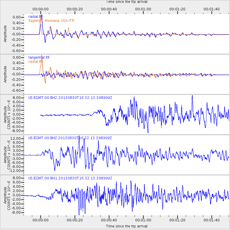
EGMT Eagleton, Montana, USA - Earthquake Result Viewer
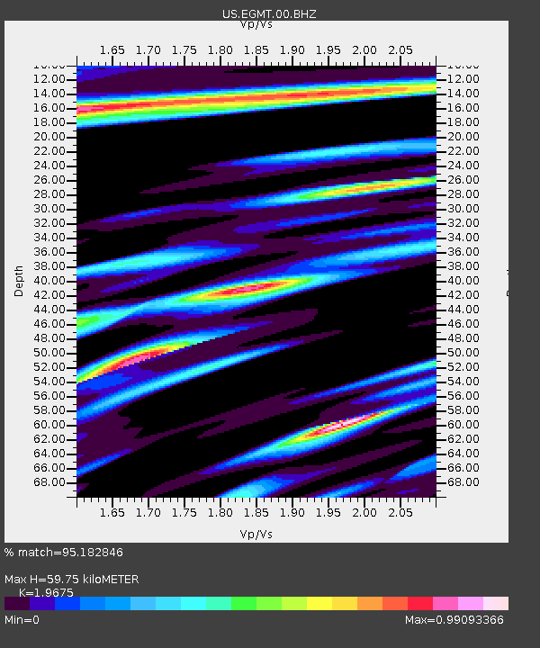
Earthquake location: Andreanof Islands, Aleutian Is.
Earthquake latitude/longitude: 51.5/-175.2
Earthquake time(UTC): 2013/08/30 (242) 16:25:02 GMT
Earthquake Depth: 29 km
Earthquake Magnitude: 7.0 MWW, 6.5 ML, 6.8 MI, 6.9 MWC, 6.9 MWB, 7.0 MWW, 7.0 MI, 7.0 MWC
Earthquake Catalog/Contributor: NEIC PDE/NEIC COMCAT
Network: US United States National Seismic Network
Station: EGMT Eagleton, Montana, USA
Lat/Lon: 48.02 N/109.75 W
Elevation: 1055 m
Distance: 41.2 deg
Az: 68.117 deg
Baz: 300.305 deg
Ray Param: 0.07391209
Estimated Moho Depth: 59.75 km
Estimated Crust Vp/Vs: 1.97
Assumed Crust Vp: 6.438 km/s
Estimated Crust Vs: 3.272 km/s
Estimated Crust Poisson's Ratio: 0.33
Radial Match: 95.182846 %
Radial Bump: 400
Transverse Match: 84.778 %
Transverse Bump: 400
SOD ConfigId: 626651
Insert Time: 2014-04-18 05:32:24.493 +0000
GWidth: 2.5
Max Bumps: 400
Tol: 0.001

Signal To Noise

ChannelStoNSTALTA
US:EGMT:00:BHZ:20130830T16:32:13.398999Z24.1814442.0141727E-68.329414E-8
US:EGMT:00:BH1:20130830T16:32:13.398999Z4.1214888.393959E-72.036633E-7
US:EGMT:00:BH2:20130830T16:32:13.398999Z7.04607341.2236686E-61.7366673E-7
Arrivals
Ps9.6 SECOND
PpPs26 SECOND
PsPs/PpSs35 SECOND