ELK Elko, Nevada, USA - Earthquake Result Viewer
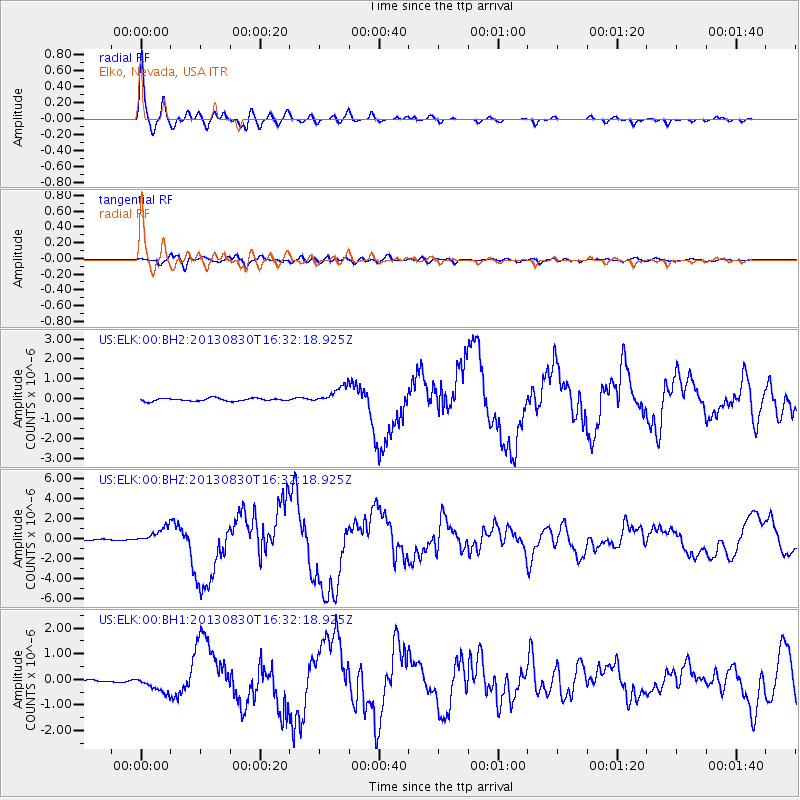
Earthquake location: Andreanof Islands, Aleutian Is.
Earthquake latitude/longitude: 51.5/-175.2
Earthquake time(UTC): 2013/08/30 (242) 16:25:02 GMT
Earthquake Depth: 29 km
Earthquake Magnitude: 7.0 MWW, 6.5 ML, 6.8 MI, 6.9 MWC, 6.9 MWB, 7.0 MWW, 7.0 MI, 7.0 MWC
Earthquake Catalog/Contributor: NEIC PDE/NEIC COMCAT
Network: US United States National Seismic Network
Station: ELK Elko, Nevada, USA
Lat/Lon: 40.74 N/115.24 W
Elevation: 2210 m
Distance: 41.8 deg
Az: 80.567 deg
Baz: 305.814 deg
Ray Param: 0.073486075
Estimated Moho Depth: 35.5 km
Estimated Crust Vp/Vs: 1.63
Assumed Crust Vp: 6.276 km/s
Estimated Crust Vs: 3.838 km/s
Estimated Crust Poisson's Ratio: 0.20
Radial Match: 97.5402 %
Radial Bump: 400
Transverse Match: 82.225 %
Transverse Bump: 400
SOD ConfigId: 626651
Insert Time: 2014-04-18 05:32:27.911 +0000
GWidth: 2.5
Max Bumps: 400
Tol: 0.001

Signal To Noise

ChannelStoNSTALTA
US:ELK:00:BHZ:20130830T16:32:18.925Z15.227558.3296857E-75.4701417E-8
US:ELK:00:BH1:20130830T16:32:18.925Z7.9308793.257915E-74.1078863E-8
US:ELK:00:BH2:20130830T16:32:18.925Z6.2314584.4975226E-77.217449E-8
Arrivals
Ps3.9 SECOND
PpPs14 SECOND
PsPs/PpSs18 SECOND