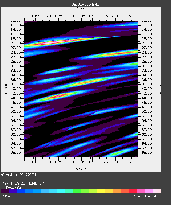
GLMI Grayling, Michigan, USA - Earthquake Result Viewer
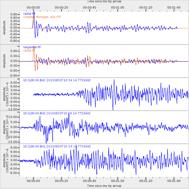
Earthquake location: Andreanof Islands, Aleutian Is.
Earthquake latitude/longitude: 51.5/-175.2
Earthquake time(UTC): 2013/08/30 (242) 16:25:02 GMT
Earthquake Depth: 29 km
Earthquake Magnitude: 7.0 MWW, 6.5 ML, 6.8 MI, 6.9 MWC, 6.9 MWB, 7.0 MWW, 7.0 MI, 7.0 MWC
Earthquake Catalog/Contributor: NEIC PDE/NEIC COMCAT
Network: US United States National Seismic Network
Station: GLMI Grayling, Michigan, USA
Lat/Lon: 44.82 N/84.62 W
Elevation: 387 m
Distance: 57.0 deg
Az: 57.995 deg
Baz: 311.905 deg
Ray Param: 0.06369316
Estimated Moho Depth: 19.25 km
Estimated Crust Vp/Vs: 1.74
Assumed Crust Vp: 6.483 km/s
Estimated Crust Vs: 3.736 km/s
Estimated Crust Poisson's Ratio: 0.25
Radial Match: 91.70171 %
Radial Bump: 400
Transverse Match: 82.958305 %
Transverse Bump: 400
SOD ConfigId: 626651
Insert Time: 2014-04-18 05:32:33.815 +0000
GWidth: 2.5
Max Bumps: 400
Tol: 0.001

Signal To Noise

ChannelStoNSTALTA
US:GLMI:00:BHZ:20130830T16:34:14.773999Z15.9520424.1044423E-62.572989E-7
US:GLMI:00:BH1:20130830T16:34:14.773999Z3.20525961.393304E-64.3469305E-7
US:GLMI:00:BH2:20130830T16:34:14.773999Z3.59356261.3621901E-63.7906398E-7
Arrivals
Ps2.3 SECOND
PpPs7.7 SECOND
PsPs/PpSs10 SECOND