LRAL Lakeview Retreat, Alabama, USA - Earthquake Result Viewer
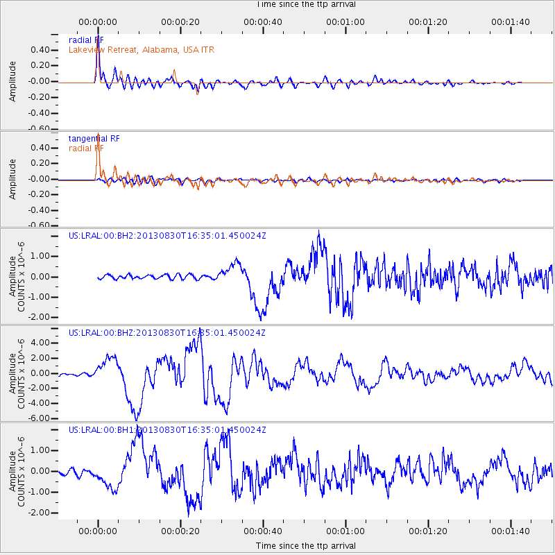
Earthquake location: Andreanof Islands, Aleutian Is.
Earthquake latitude/longitude: 51.5/-175.2
Earthquake time(UTC): 2013/08/30 (242) 16:25:02 GMT
Earthquake Depth: 29 km
Earthquake Magnitude: 7.0 MWW, 6.5 ML, 6.8 MI, 6.9 MWC, 6.9 MWB, 7.0 MWW, 7.0 MI, 7.0 MWC
Earthquake Catalog/Contributor: NEIC PDE/NEIC COMCAT
Network: US United States National Seismic Network
Station: LRAL Lakeview Retreat, Alabama, USA
Lat/Lon: 33.03 N/87.00 W
Elevation: 130 m
Distance: 63.9 deg
Az: 69.218 deg
Baz: 315.961 deg
Ray Param: 0.05922943
Estimated Moho Depth: 24.5 km
Estimated Crust Vp/Vs: 2.10
Assumed Crust Vp: 6.565 km/s
Estimated Crust Vs: 3.133 km/s
Estimated Crust Poisson's Ratio: 0.35
Radial Match: 95.89976 %
Radial Bump: 400
Transverse Match: 71.0532 %
Transverse Bump: 400
SOD ConfigId: 626651
Insert Time: 2014-04-18 05:33:03.077 +0000
GWidth: 2.5
Max Bumps: 400
Tol: 0.001

Signal To Noise

ChannelStoNSTALTA
US:LRAL:00:BHZ:20130830T16:35:01.450024Z11.3574711.7685527E-61.5571712E-7
US:LRAL:00:BH1:20130830T16:35:01.450024Z6.23948766.275155E-71.0057163E-7
US:LRAL:00:BH2:20130830T16:35:01.450024Z5.05177264.9631535E-79.824578E-8
Arrivals
Ps4.2 SECOND
PpPs11 SECOND
PsPs/PpSs15 SECOND