MSO Missoula, Montana, USA - Earthquake Result Viewer
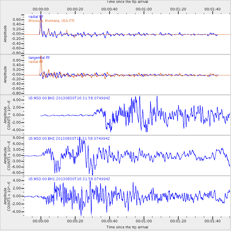
Earthquake location: Andreanof Islands, Aleutian Is.
Earthquake latitude/longitude: 51.5/-175.2
Earthquake time(UTC): 2013/08/30 (242) 16:25:02 GMT
Earthquake Depth: 29 km
Earthquake Magnitude: 7.0 MWW, 6.5 ML, 6.8 MI, 6.9 MWC, 6.9 MWB, 7.0 MWW, 7.0 MI, 7.0 MWC
Earthquake Catalog/Contributor: NEIC PDE/NEIC COMCAT
Network: US United States National Seismic Network
Station: MSO Missoula, Montana, USA
Lat/Lon: 46.83 N/113.94 W
Elevation: 1264 m
Distance: 39.3 deg
Az: 71.93 deg
Baz: 300.144 deg
Ray Param: 0.07500978
Estimated Moho Depth: 25.25 km
Estimated Crust Vp/Vs: 2.10
Assumed Crust Vp: 6.353 km/s
Estimated Crust Vs: 3.029 km/s
Estimated Crust Poisson's Ratio: 0.35
Radial Match: 95.54812 %
Radial Bump: 400
Transverse Match: 83.155594 %
Transverse Bump: 400
SOD ConfigId: 626651
Insert Time: 2014-04-18 05:33:12.613 +0000
GWidth: 2.5
Max Bumps: 400
Tol: 0.001

Signal To Noise

ChannelStoNSTALTA
US:MSO:00:BHZ:20130830T16:31:58.074994Z25.3261721.7064864E-66.738035E-8
US:MSO:00:BH1:20130830T16:31:58.074994Z8.6059826.9350006E-78.058349E-8
US:MSO:00:BH2:20130830T16:31:58.074994Z9.5143168.4864007E-78.919613E-8
Arrivals
Ps4.6 SECOND
PpPs12 SECOND
PsPs/PpSs16 SECOND