
OGNE Ogallala, Nebraska, USA - Earthquake Result Viewer
| ||||||||||||||||||
| ||||||||||||||||||
| ||||||||||||||||||
|
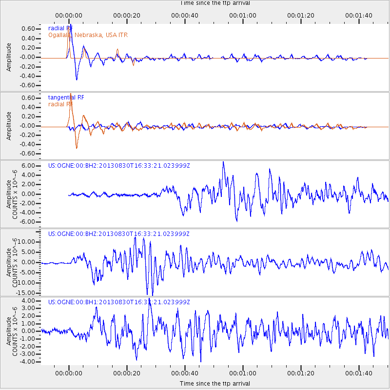
Signal To Noise
| Channel | StoN | STA | LTA |
| US:OGNE:00:BHZ:20130830T16:33:21.023999Z | 10.586376 | 1.7929949E-6 | 1.6936814E-7 |
| US:OGNE:00:BH1:20130830T16:33:21.023999Z | 1.7414588 | 4.264094E-7 | 2.448576E-7 |
| US:OGNE:00:BH2:20130830T16:33:21.023999Z | 3.69062 | 8.037364E-7 | 2.1777815E-7 |
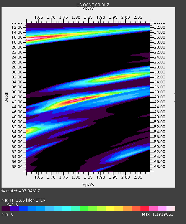
| Arrivals | |
| Ps | 1.6 SECOND |
| PpPs | 6.2 SECOND |
| PsPs/PpSs | 7.8 SECOND |

