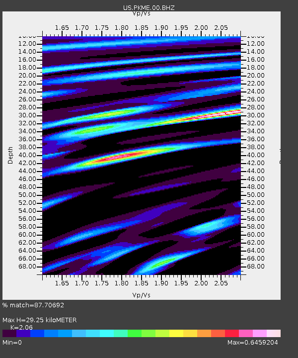
PKME Peaks-Kenny State Park, Maine, USA - Earthquake Result Viewer
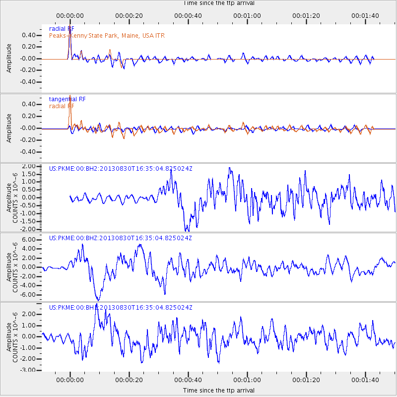
Earthquake location: Andreanof Islands, Aleutian Is.
Earthquake latitude/longitude: 51.5/-175.2
Earthquake time(UTC): 2013/08/30 (242) 16:25:02 GMT
Earthquake Depth: 29 km
Earthquake Magnitude: 7.0 MWW, 6.5 ML, 6.8 MI, 6.9 MWC, 6.9 MWB, 7.0 MWW, 7.0 MI, 7.0 MWC
Earthquake Catalog/Contributor: NEIC PDE/NEIC COMCAT
Network: US United States National Seismic Network
Station: PKME Peaks-Kenny State Park, Maine, USA
Lat/Lon: 45.26 N/69.29 W
Elevation: 108 m
Distance: 64.4 deg
Az: 48.84 deg
Baz: 318.254 deg
Ray Param: 0.05889205
Estimated Moho Depth: 29.25 km
Estimated Crust Vp/Vs: 2.06
Assumed Crust Vp: 6.419 km/s
Estimated Crust Vs: 3.116 km/s
Estimated Crust Poisson's Ratio: 0.35
Radial Match: 87.70692 %
Radial Bump: 400
Transverse Match: 55.824013 %
Transverse Bump: 400
SOD ConfigId: 626651
Insert Time: 2014-04-18 05:33:31.413 +0000
GWidth: 2.5
Max Bumps: 400
Tol: 0.001

Signal To Noise

ChannelStoNSTALTA
US:PKME:00:BHZ:20130830T16:35:04.825024Z7.86859462.3748041E-63.0180792E-7
US:PKME:00:BH1:20130830T16:35:04.825024Z3.3403949.545178E-72.8575005E-7
US:PKME:00:BH2:20130830T16:35:04.825024Z4.645467.7750775E-71.6736938E-7
Arrivals
Ps5.0 SECOND
PpPs13 SECOND
PsPs/PpSs18 SECOND