LON Longmire (broad-band and DWWSSN) - Earthquake Result Viewer
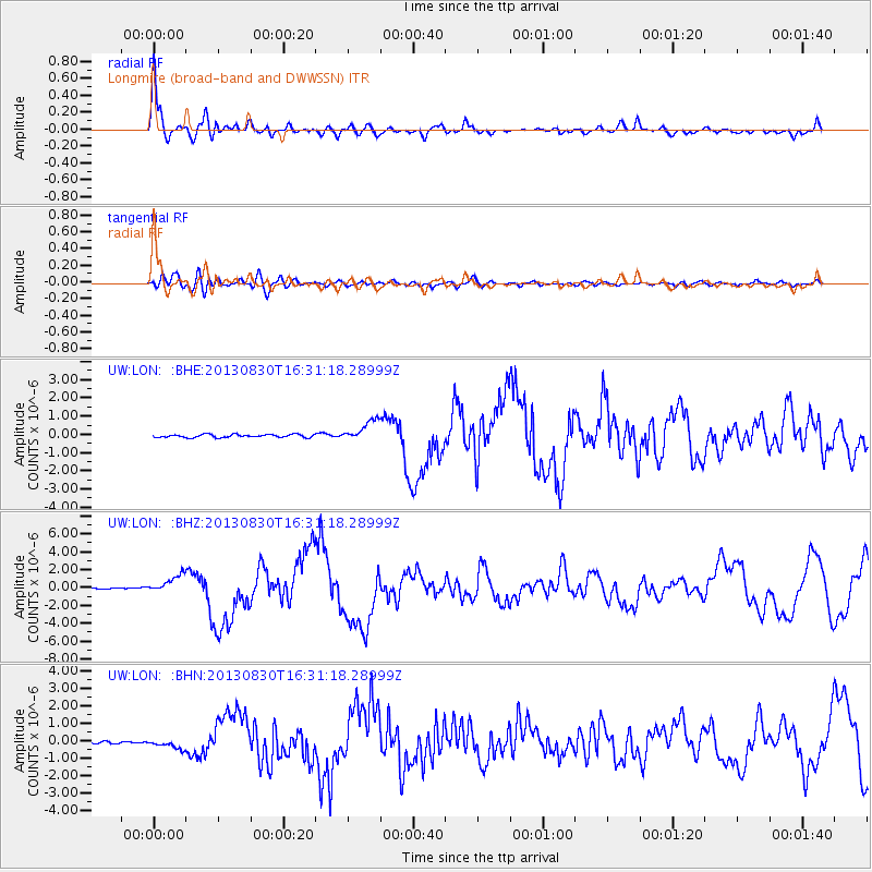
Earthquake location: Andreanof Islands, Aleutian Is.
Earthquake latitude/longitude: 51.5/-175.2
Earthquake time(UTC): 2013/08/30 (242) 16:25:02 GMT
Earthquake Depth: 29 km
Earthquake Magnitude: 7.0 MWW, 6.5 ML, 6.8 MI, 6.9 MWC, 6.9 MWB, 7.0 MWW, 7.0 MI, 7.0 MWC
Earthquake Catalog/Contributor: NEIC PDE/NEIC COMCAT
Network: UW Pacific Northwest Regional Seismic Network
Station: LON Longmire (broad-band and DWWSSN)
Lat/Lon: 46.75 N/121.81 W
Elevation: 850 m
Distance: 34.6 deg
Az: 76.413 deg
Baz: 298.008 deg
Ray Param: 0.077601455
Estimated Moho Depth: 48.5 km
Estimated Crust Vp/Vs: 2.01
Assumed Crust Vp: 6.597 km/s
Estimated Crust Vs: 3.291 km/s
Estimated Crust Poisson's Ratio: 0.33
Radial Match: 90.834526 %
Radial Bump: 400
Transverse Match: 73.852234 %
Transverse Bump: 400
SOD ConfigId: 626651
Insert Time: 2014-04-18 05:35:18.292 +0000
GWidth: 2.5
Max Bumps: 400
Tol: 0.001

Signal To Noise

ChannelStoNSTALTA
UW:LON: :BHZ:20130830T16:31:18.28999Z13.5008751.0171675E-67.534086E-8
UW:LON: :BHN:20130830T16:31:18.28999Z4.25000672.6553434E-76.247857E-8
UW:LON: :BHE:20130830T16:31:18.28999Z6.743155.793551E-78.591758E-8
Arrivals
Ps7.9 SECOND
PpPs21 SECOND
PsPs/PpSs29 SECOND