YHH Holmes Hill, YNP, WY, USA - Earthquake Result Viewer
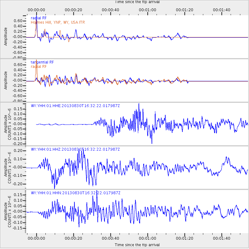
Earthquake location: Andreanof Islands, Aleutian Is.
Earthquake latitude/longitude: 51.5/-175.2
Earthquake time(UTC): 2013/08/30 (242) 16:25:02 GMT
Earthquake Depth: 29 km
Earthquake Magnitude: 7.0 MWW, 6.5 ML, 6.8 MI, 6.9 MWC, 6.9 MWB, 7.0 MWW, 7.0 MI, 7.0 MWC
Earthquake Catalog/Contributor: NEIC PDE/NEIC COMCAT
Network: WY Yellowstone Wyoming Seismic Network
Station: YHH Holmes Hill, YNP, WY, USA
Lat/Lon: 44.79 N/110.85 W
Elevation: 2717 m
Distance: 42.2 deg
Az: 72.858 deg
Baz: 303.055 deg
Ray Param: 0.07325326
Estimated Moho Depth: 24.25 km
Estimated Crust Vp/Vs: 2.07
Assumed Crust Vp: 6.35 km/s
Estimated Crust Vs: 3.071 km/s
Estimated Crust Poisson's Ratio: 0.35
Radial Match: 89.01762 %
Radial Bump: 400
Transverse Match: 83.10438 %
Transverse Bump: 400
SOD ConfigId: 626651
Insert Time: 2014-04-18 05:37:05.100 +0000
GWidth: 2.5
Max Bumps: 400
Tol: 0.001

Signal To Noise

ChannelStoNSTALTA
WY:YHH:01:HHZ:20130830T16:32:22.017987Z32.212494.2689432E-81.3252448E-9
WY:YHH:01:HHN:20130830T16:32:22.017987Z10.7795231.617508E-81.5005377E-9
WY:YHH:01:HHE:20130830T16:32:22.017987Z7.58017732.0247594E-82.671124E-9
Arrivals
Ps4.3 SECOND
PpPs11 SECOND
PsPs/PpSs15 SECOND