
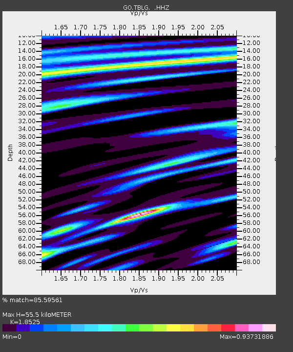
TBLG Delisi, Georgia - Earthquake Result Viewer
| ||||||||||||||||||
| ||||||||||||||||||
| ||||||||||||||||||
|
Signal To Noise
| Channel | StoN | STA | LTA |
| GO:TBLG: :HHZ:20130831T06:50:19.33999Z | 12.384873 | 8.756279E-7 | 7.07014E-8 |
| GO:TBLG: :HHN:20130831T06:50:19.33999Z | 2.7455702 | 1.9209962E-7 | 6.9967115E-8 |
| GO:TBLG: :HHE:20130831T06:50:19.33999Z | 1.5633631 | 8.960776E-8 | 5.731731E-8 |
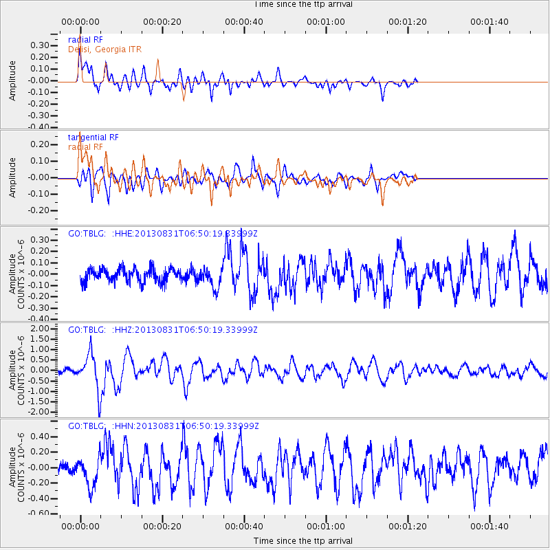
| Arrivals | |
| Ps | 7.7 SECOND |
| PpPs | 25 SECOND |
| PsPs/PpSs | 32 SECOND |

