AAK Ala Archa, Kyrgyzstan - Earthquake Result Viewer
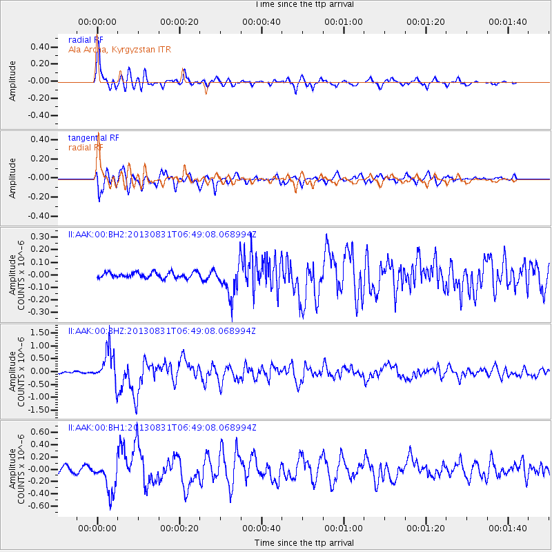
Earthquake location: Andreanof Islands, Aleutian Is.
Earthquake latitude/longitude: 51.2/-174.9
Earthquake time(UTC): 2013/08/31 (243) 06:38:36 GMT
Earthquake Depth: 18 km
Earthquake Magnitude: 6.0 MWW, 5.5 ML, 5.9 MWB, 5.9 MWC, 6.0 MWC, 6.0 MI, 6.0 MWW
Earthquake Catalog/Contributor: NEIC PDE/NEIC COMCAT
Network: II Global Seismograph Network (GSN - IRIS/IDA)
Station: AAK Ala Archa, Kyrgyzstan
Lat/Lon: 42.64 N/74.49 E
Elevation: 1645 m
Distance: 68.8 deg
Az: 312.173 deg
Baz: 39.152 deg
Ray Param: 0.056062978
Estimated Moho Depth: 52.0 km
Estimated Crust Vp/Vs: 1.68
Assumed Crust Vp: 6.306 km/s
Estimated Crust Vs: 3.754 km/s
Estimated Crust Poisson's Ratio: 0.23
Radial Match: 94.0947 %
Radial Bump: 400
Transverse Match: 91.76001 %
Transverse Bump: 400
SOD ConfigId: 626651
Insert Time: 2014-04-18 06:19:39.120 +0000
GWidth: 2.5
Max Bumps: 400
Tol: 0.001

Signal To Noise

ChannelStoNSTALTA
II:AAK:00:BHZ:20130831T06:49:08.068994Z20.5923736.760573E-73.283047E-8
II:AAK:00:BH1:20130831T06:49:08.068994Z7.70076942.7094876E-73.5184634E-8
II:AAK:00:BH2:20130831T06:49:08.068994Z6.04098031.3656849E-72.2607006E-8
Arrivals
Ps5.8 SECOND
PpPs21 SECOND
PsPs/PpSs27 SECOND