
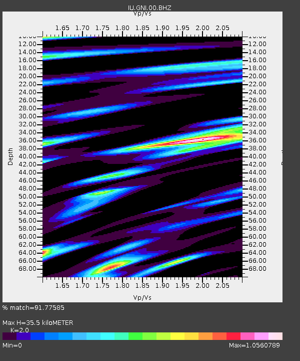
GNI Garni, Armenia - Earthquake Result Viewer
| ||||||||||||||||||
| ||||||||||||||||||
| ||||||||||||||||||
|
Signal To Noise
| Channel | StoN | STA | LTA |
| IU:GNI:00:BHZ:20130831T06:50:26.91897Z | 8.6236725 | 6.9826837E-7 | 8.097111E-8 |
| IU:GNI:00:BH1:20130831T06:50:26.91897Z | 3.3802226 | 2.5838668E-7 | 7.644073E-8 |
| IU:GNI:00:BH2:20130831T06:50:26.91897Z | 1.8191439 | 1.2952876E-7 | 7.120314E-8 |
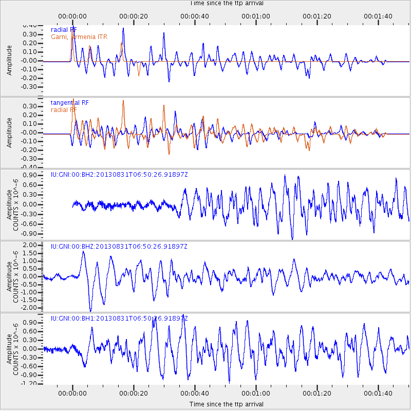
| Arrivals | |
| Ps | 5.8 SECOND |
| PpPs | 17 SECOND |
| PsPs/PpSs | 22 SECOND |

