You are here: Home > Network List > TA - USArray Transportable Network (new EarthScope stations) Stations List
> Station D50A G1974 Best Township, ON, CAN > Earthquake Result Viewer
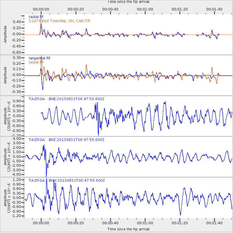
D50A G1974 Best Township, ON, CAN - Earthquake Result Viewer
*The percent match for this event was below the threshold and hence no stack was calculated.
| Earthquake location: |
Andreanof Islands, Aleutian Is. |
| Earthquake latitude/longitude: |
51.2/-174.9 |
| Earthquake time(UTC): |
2013/08/31 (243) 06:38:36 GMT |
| Earthquake Depth: |
18 km |
| Earthquake Magnitude: |
6.0 MWW, 5.5 ML, 5.9 MWB, 5.9 MWC, 6.0 MWC, 6.0 MI, 6.0 MWW |
| Earthquake Catalog/Contributor: |
NEIC PDE/NEIC COMCAT |
|
| Network: |
TA USArray Transportable Network (new EarthScope stations) |
| Station: |
D50A G1974 Best Township, ON, CAN |
| Lat/Lon: |
47.17 N/79.84 W |
| Elevation: |
331 m |
|
| Distance: |
58.0 deg |
| Az: |
53.291 deg |
| Baz: |
312.387 deg |
| Ray Param: |
$rayparam |
*The percent match for this event was below the threshold and hence was not used in the summary stack. |
|
| Radial Match: |
62.88322 % |
| Radial Bump: |
400 |
| Transverse Match: |
76.921005 % |
| Transverse Bump: |
379 |
| SOD ConfigId: |
626651 |
| Insert Time: |
2014-04-18 06:31:59.496 +0000 |
| GWidth: |
2.5 |
| Max Bumps: |
400 |
| Tol: |
0.001 |
|
Signal To Noise
| Channel | StoN | STA | LTA |
| TA:D50A: :BHZ:20130831T06:47:56.600Z | 4.131373 | 1.6427591E-6 | 3.9763032E-7 |
| TA:D50A: :BHN:20130831T06:47:56.600Z | 2.1437867 | 4.792758E-7 | 2.2356507E-7 |
| TA:D50A: :BHE:20130831T06:47:56.600Z | 1.607362 | 4.767676E-7 | 2.9661496E-7 |
| Arrivals |
| Ps | |
| PpPs | |
| PsPs/PpSs | |


