ARU Arti, Russia - Earthquake Result Viewer
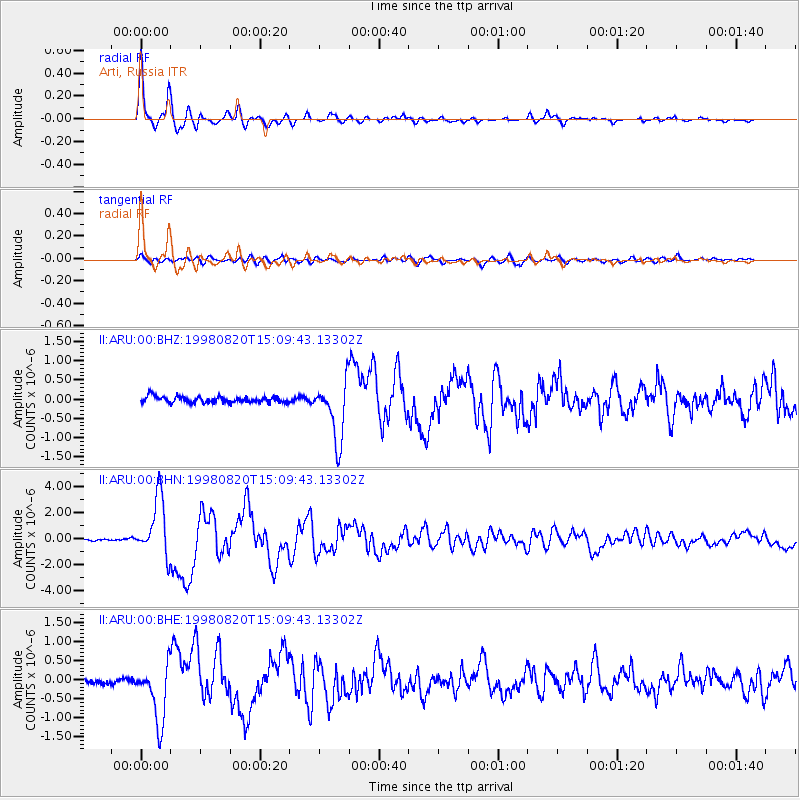
Earthquake location: Rat Islands, Aleutian Islands
Earthquake latitude/longitude: 51.6/175.2
Earthquake time(UTC): 1998/08/20 (232) 15:00:08 GMT
Earthquake Depth: 33 km
Earthquake Magnitude: 5.6 MB, 6.0 MS, 6.2 UNKNOWN, 6.2 MW
Earthquake Catalog/Contributor: WHDF/NEIC
Network: II Global Seismograph Network (GSN - IRIS/IDA)
Station: ARU Arti, Russia
Lat/Lon: 56.43 N/58.56 E
Elevation: 250 m
Distance: 60.4 deg
Az: 325.174 deg
Baz: 39.861 deg
Ray Param: 0.061527755
Estimated Moho Depth: 38.75 km
Estimated Crust Vp/Vs: 1.73
Assumed Crust Vp: 6.159 km/s
Estimated Crust Vs: 3.555 km/s
Estimated Crust Poisson's Ratio: 0.25
Radial Match: 97.202034 %
Radial Bump: 368
Transverse Match: 89.722885 %
Transverse Bump: 400
SOD ConfigId: 4480
Insert Time: 2010-03-01 16:22:54.481 +0000
GWidth: 2.5
Max Bumps: 400
Tol: 0.001

Signal To Noise

ChannelStoNSTALTA
II:ARU:00:BHN:19980820T15:09:43.13302Z29.7489192.2639792E-67.610291E-8
II:ARU:00:BHE:19980820T15:09:43.13302Z10.5612657.5724205E-77.169994E-8
II:ARU:00:BHZ:19980820T15:09:43.13302Z9.7127767.638185E-77.864059E-8
Arrivals
Ps4.8 SECOND
PpPs16 SECOND
PsPs/PpSs21 SECOND