
L48A N Adams, MI, USA - Earthquake Result Viewer
| ||||||||||||||||||
| ||||||||||||||||||
| ||||||||||||||||||
|
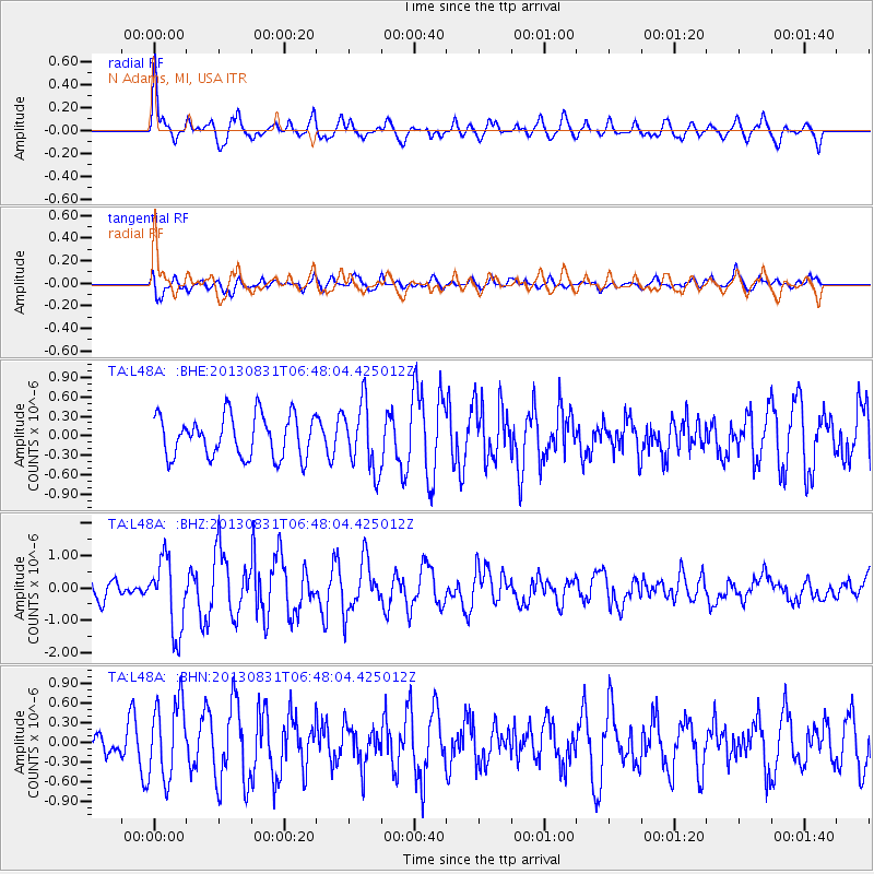
Signal To Noise
| Channel | StoN | STA | LTA |
| TA:L48A: :BHZ:20130831T06:48:04.425012Z | 3.3395019 | 1.1051578E-6 | 3.3093494E-7 |
| TA:L48A: :BHN:20130831T06:48:04.425012Z | 3.5646896 | 5.944907E-7 | 1.6677207E-7 |
| TA:L48A: :BHE:20130831T06:48:04.425012Z | 1.5953679 | 5.133645E-7 | 3.217844E-7 |
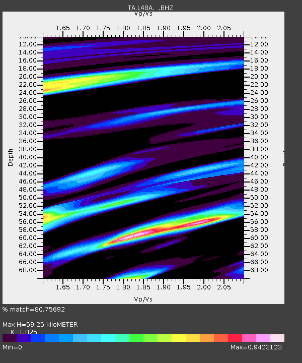
| Arrivals | |
| Ps | 7.9 SECOND |
| PpPs | 25 SECOND |
| PsPs/PpSs | 32 SECOND |

