N41A Harden Midland Farm, Stronghurst, IL, USA - Earthquake Result Viewer
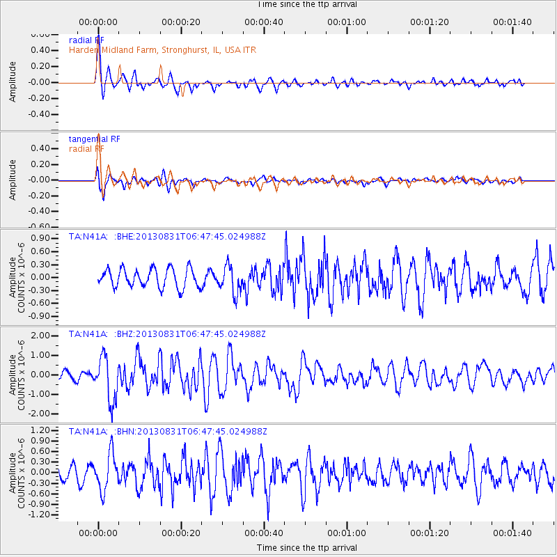
Earthquake location: Andreanof Islands, Aleutian Is.
Earthquake latitude/longitude: 51.2/-174.9
Earthquake time(UTC): 2013/08/31 (243) 06:38:36 GMT
Earthquake Depth: 18 km
Earthquake Magnitude: 6.0 MWW, 5.5 ML, 5.9 MWB, 5.9 MWC, 6.0 MWC, 6.0 MI, 6.0 MWW
Earthquake Catalog/Contributor: NEIC PDE/NEIC COMCAT
Network: TA USArray Transportable Network (new EarthScope stations)
Station: N41A Harden Midland Farm, Stronghurst, IL, USA
Lat/Lon: 40.71 N/90.86 W
Elevation: 226 m
Distance: 56.3 deg
Az: 65.319 deg
Baz: 311.289 deg
Ray Param: 0.06419745
Estimated Moho Depth: 22.5 km
Estimated Crust Vp/Vs: 1.67
Assumed Crust Vp: 6.498 km/s
Estimated Crust Vs: 3.891 km/s
Estimated Crust Poisson's Ratio: 0.22
Radial Match: 88.40045 %
Radial Bump: 400
Transverse Match: 61.144657 %
Transverse Bump: 400
SOD ConfigId: 626651
Insert Time: 2014-04-18 06:37:32.367 +0000
GWidth: 2.5
Max Bumps: 400
Tol: 0.001

Signal To Noise

ChannelStoNSTALTA
TA:N41A: :BHZ:20130831T06:47:45.024988Z4.84318161.1418186E-62.3575795E-7
TA:N41A: :BHN:20130831T06:47:45.024988Z2.70517565.3741667E-71.986624E-7
TA:N41A: :BHE:20130831T06:47:45.024988Z1.52362073.2775674E-72.1511701E-7
Arrivals
Ps2.5 SECOND
PpPs8.7 SECOND
PsPs/PpSs11 SECOND