O03E Paynes Creek, CA, USA - Earthquake Result Viewer
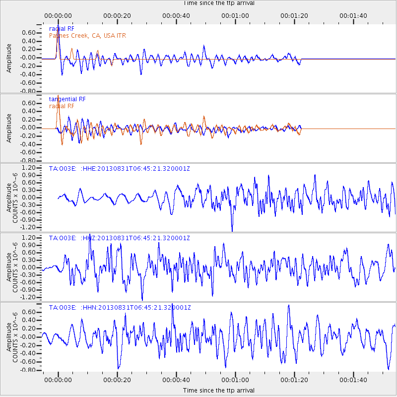
Earthquake location: Andreanof Islands, Aleutian Is.
Earthquake latitude/longitude: 51.2/-174.9
Earthquake time(UTC): 2013/08/31 (243) 06:38:36 GMT
Earthquake Depth: 18 km
Earthquake Magnitude: 6.0 MWW, 5.5 ML, 5.9 MWB, 5.9 MWC, 6.0 MWC, 6.0 MI, 6.0 MWW
Earthquake Catalog/Contributor: NEIC PDE/NEIC COMCAT
Network: TA USArray Transportable Network (new EarthScope stations)
Station: O03E Paynes Creek, CA, USA
Lat/Lon: 40.29 N/121.80 W
Elevation: 967 m
Distance: 37.9 deg
Az: 85.503 deg
Baz: 304.979 deg
Ray Param: 0.075870894
Estimated Moho Depth: 68.25 km
Estimated Crust Vp/Vs: 2.01
Assumed Crust Vp: 6.566 km/s
Estimated Crust Vs: 3.263 km/s
Estimated Crust Poisson's Ratio: 0.34
Radial Match: 82.24697 %
Radial Bump: 400
Transverse Match: 73.455505 %
Transverse Bump: 400
SOD ConfigId: 626651
Insert Time: 2014-04-18 06:38:08.524 +0000
GWidth: 2.5
Max Bumps: 400
Tol: 0.001

Signal To Noise

ChannelStoNSTALTA
TA:O03E: :HHZ:20130831T06:45:21.320001Z4.66734552.7800252E-75.9563305E-8
TA:O03E: :HHN:20130831T06:45:21.320001Z1.54218111.3638495E-78.84364E-8
TA:O03E: :HHE:20130831T06:45:21.320001Z1.36428811.8911075E-71.3861496E-7
Arrivals
Ps11 SECOND
PpPs29 SECOND
PsPs/PpSs41 SECOND