Q51A Peebles, OH, USA - Earthquake Result Viewer
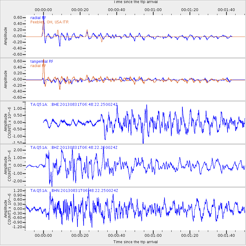
Earthquake location: Andreanof Islands, Aleutian Is.
Earthquake latitude/longitude: 51.2/-174.9
Earthquake time(UTC): 2013/08/31 (243) 06:38:36 GMT
Earthquake Depth: 18 km
Earthquake Magnitude: 6.0 MWW, 5.5 ML, 5.9 MWB, 5.9 MWC, 6.0 MWC, 6.0 MI, 6.0 MWW
Earthquake Catalog/Contributor: NEIC PDE/NEIC COMCAT
Network: TA USArray Transportable Network (new EarthScope stations)
Station: Q51A Peebles, OH, USA
Lat/Lon: 39.03 N/83.35 W
Elevation: 362 m
Distance: 61.7 deg
Az: 62.167 deg
Baz: 314.464 deg
Ray Param: 0.060689434
Estimated Moho Depth: 13.75 km
Estimated Crust Vp/Vs: 2.10
Assumed Crust Vp: 6.232 km/s
Estimated Crust Vs: 2.975 km/s
Estimated Crust Poisson's Ratio: 0.35
Radial Match: 85.685905 %
Radial Bump: 400
Transverse Match: 62.9644 %
Transverse Bump: 400
SOD ConfigId: 626651
Insert Time: 2014-04-18 06:39:25.358 +0000
GWidth: 2.5
Max Bumps: 400
Tol: 0.001

Signal To Noise

ChannelStoNSTALTA
TA:Q51A: :BHZ:20130831T06:48:22.250024Z7.086791.2578113E-61.7748675E-7
TA:Q51A: :BHN:20130831T06:48:22.250024Z2.5434294.190971E-71.6477641E-7
TA:Q51A: :BHE:20130831T06:48:22.250024Z3.4059684.960828E-71.4565104E-7
Arrivals
Ps2.5 SECOND
PpPs6.6 SECOND
PsPs/PpSs9.1 SECOND