
R49A Shelbyville, KY, USA - Earthquake Result Viewer
| ||||||||||||||||||
| ||||||||||||||||||
| ||||||||||||||||||
|
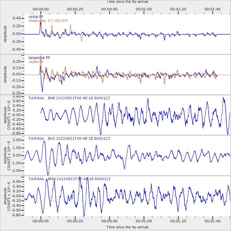
Signal To Noise
| Channel | StoN | STA | LTA |
| TA:R49A: :BHZ:20130831T06:48:18.800012Z | 3.93908 | 1.4910113E-6 | 3.7851765E-7 |
| TA:R49A: :BHN:20130831T06:48:18.800012Z | 2.134 | 4.5338288E-7 | 2.1245683E-7 |
| TA:R49A: :BHE:20130831T06:48:18.800012Z | 1.7816157 | 3.5121812E-7 | 1.9713461E-7 |
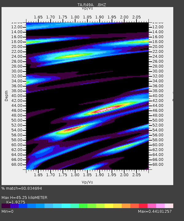
| Arrivals | |
| Ps | 6.7 SECOND |
| PpPs | 20 SECOND |
| PsPs/PpSs | 26 SECOND |

