
R51A Hillsboro, KY, USA - Earthquake Result Viewer
| ||||||||||||||||||
| ||||||||||||||||||
| ||||||||||||||||||
|
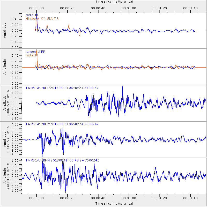
Signal To Noise
| Channel | StoN | STA | LTA |
| TA:R51A: :BHZ:20130831T06:48:24.750024Z | 11.033486 | 1.5243744E-6 | 1.3815891E-7 |
| TA:R51A: :BHN:20130831T06:48:24.750024Z | 3.0763333 | 5.041132E-7 | 1.638682E-7 |
| TA:R51A: :BHE:20130831T06:48:24.750024Z | 3.7589295 | 5.058611E-7 | 1.3457586E-7 |
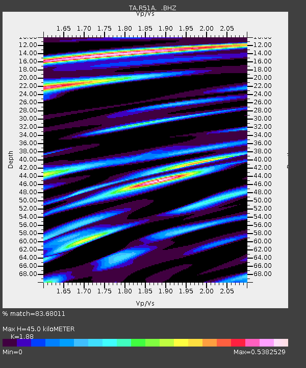
| Arrivals | |
| Ps | 6.6 SECOND |
| PpPs | 20 SECOND |
| PsPs/PpSs | 27 SECOND |

