R54A Victor, WV, USA - Earthquake Result Viewer
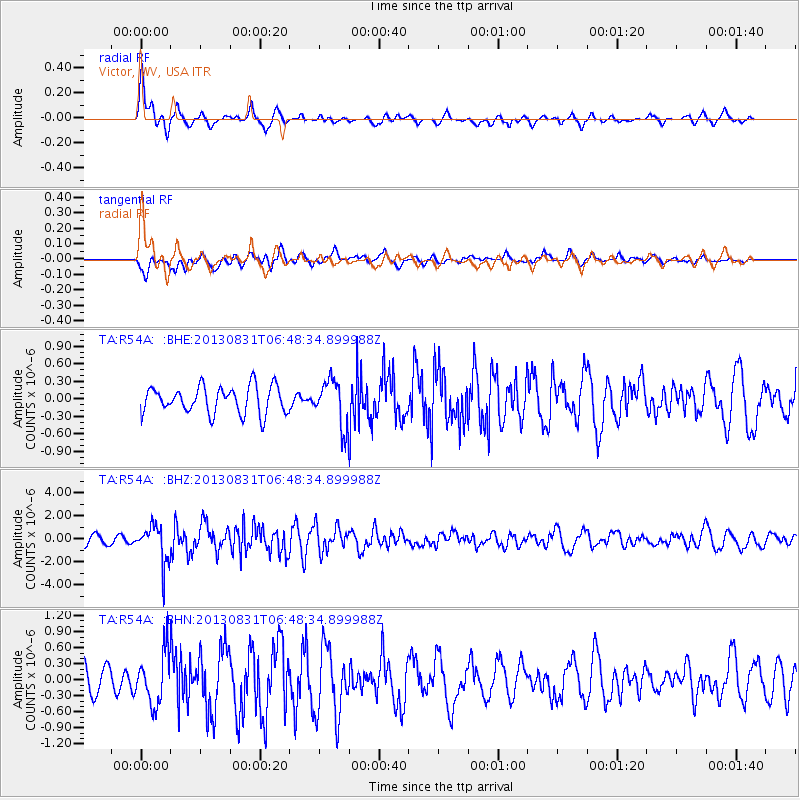
Earthquake location: Andreanof Islands, Aleutian Is.
Earthquake latitude/longitude: 51.2/-174.9
Earthquake time(UTC): 2013/08/31 (243) 06:38:36 GMT
Earthquake Depth: 18 km
Earthquake Magnitude: 6.0 MWW, 5.5 ML, 5.9 MWB, 5.9 MWC, 6.0 MWC, 6.0 MI, 6.0 MWW
Earthquake Catalog/Contributor: NEIC PDE/NEIC COMCAT
Network: TA USArray Transportable Network (new EarthScope stations)
Station: R54A Victor, WV, USA
Lat/Lon: 38.18 N/80.99 W
Elevation: 512 m
Distance: 63.6 deg
Az: 61.369 deg
Baz: 315.561 deg
Ray Param: 0.059453614
Estimated Moho Depth: 41.5 km
Estimated Crust Vp/Vs: 1.88
Assumed Crust Vp: 6.207 km/s
Estimated Crust Vs: 3.302 km/s
Estimated Crust Poisson's Ratio: 0.30
Radial Match: 84.32698 %
Radial Bump: 382
Transverse Match: 60.303688 %
Transverse Bump: 400
SOD ConfigId: 626651
Insert Time: 2014-04-18 06:40:02.879 +0000
GWidth: 2.5
Max Bumps: 400
Tol: 0.001

Signal To Noise

ChannelStoNSTALTA
TA:R54A: :BHZ:20130831T06:48:34.899988Z4.8108741.6480533E-63.4256837E-7
TA:R54A: :BHN:20130831T06:48:34.899988Z2.0910844.860238E-72.324267E-7
TA:R54A: :BHE:20130831T06:48:34.899988Z1.69293033.9184843E-72.3146164E-7
Arrivals
Ps6.1 SECOND
PpPs19 SECOND
PsPs/PpSs25 SECOND