
S50A Richmond, KY, USA - Earthquake Result Viewer
| ||||||||||||||||||
| ||||||||||||||||||
| ||||||||||||||||||
|
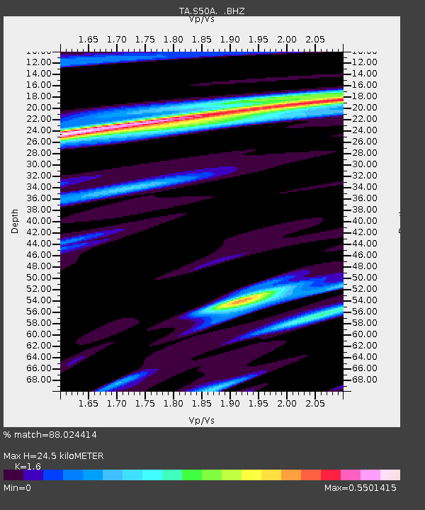
Signal To Noise
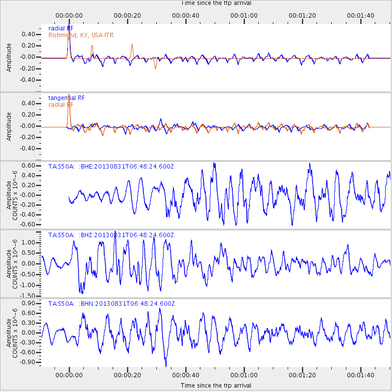
| Channel | StoN | STA | LTA |
| TA:S50A: :BHZ:20130831T06:48:24.600Z | 4.3834085 | 7.7558553E-7 | 1.7693662E-7 |
| TA:S50A: :BHN:20130831T06:48:24.600Z | 1.5553569 | 2.6053542E-7 | 1.6750845E-7 |
| TA:S50A: :BHE:20130831T06:48:24.600Z | 1.6243047 | 2.2615306E-7 | 1.3923069E-7 |
| Arrivals | |
| Ps | 2.4 SECOND |
| PpPs | 9.4 SECOND |
| PsPs/PpSs | 12 SECOND |

