
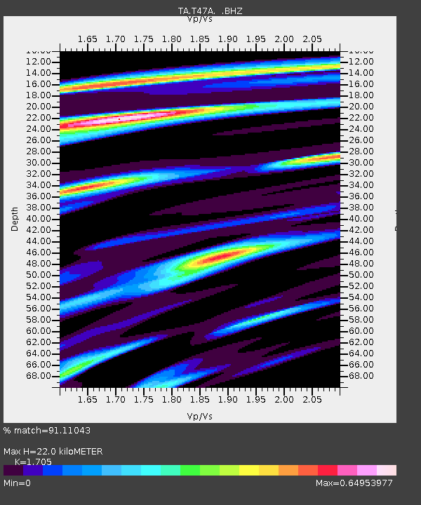
T47A Sharon Grove, KY, USA - Earthquake Result Viewer
| ||||||||||||||||||
| ||||||||||||||||||
| ||||||||||||||||||
|
Signal To Noise
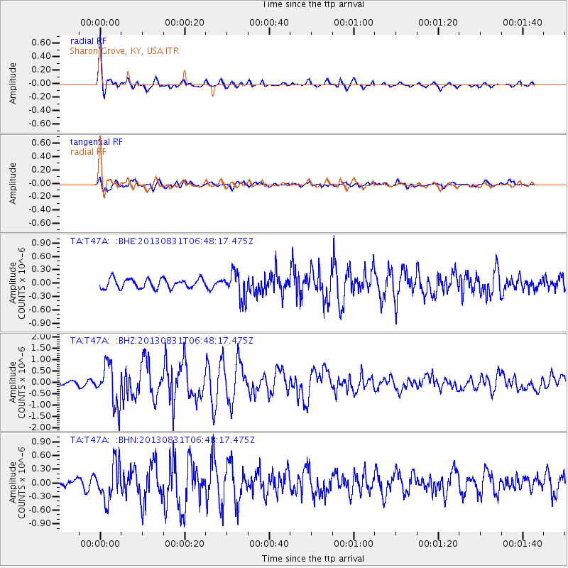
| Channel | StoN | STA | LTA |
| TA:T47A: :BHZ:20130831T06:48:17.475Z | 4.2242823 | 9.221717E-7 | 2.1830257E-7 |
| TA:T47A: :BHN:20130831T06:48:17.475Z | 2.3839374 | 4.116605E-7 | 1.7268091E-7 |
| TA:T47A: :BHE:20130831T06:48:17.475Z | 2.8510933 | 2.9827893E-7 | 1.0461913E-7 |
| Arrivals | |
| Ps | 2.5 SECOND |
| PpPs | 8.8 SECOND |
| PsPs/PpSs | 11 SECOND |

