T53A Wise, VA, USA - Earthquake Result Viewer
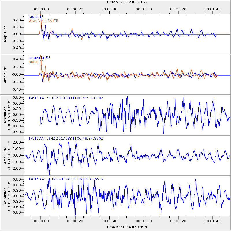
Earthquake location: Andreanof Islands, Aleutian Is.
Earthquake latitude/longitude: 51.2/-174.9
Earthquake time(UTC): 2013/08/31 (243) 06:38:36 GMT
Earthquake Depth: 18 km
Earthquake Magnitude: 6.0 MWW, 5.5 ML, 5.9 MWB, 5.9 MWC, 6.0 MWC, 6.0 MI, 6.0 MWW
Earthquake Catalog/Contributor: NEIC PDE/NEIC COMCAT
Network: TA USArray Transportable Network (new EarthScope stations)
Station: T53A Wise, VA, USA
Lat/Lon: 36.98 N/82.54 W
Elevation: 818 m
Distance: 63.6 deg
Az: 63.283 deg
Baz: 315.473 deg
Ray Param: 0.05945766
Estimated Moho Depth: 15.75 km
Estimated Crust Vp/Vs: 2.09
Assumed Crust Vp: 6.476 km/s
Estimated Crust Vs: 3.095 km/s
Estimated Crust Poisson's Ratio: 0.35
Radial Match: 81.73051 %
Radial Bump: 400
Transverse Match: 66.64129 %
Transverse Bump: 400
SOD ConfigId: 626651
Insert Time: 2014-04-18 06:41:14.210 +0000
GWidth: 2.5
Max Bumps: 400
Tol: 0.001

Signal To Noise

ChannelStoNSTALTA
TA:T53A: :BHZ:20130831T06:48:34.850Z5.7360381.240059E-62.1618736E-7
TA:T53A: :BHN:20130831T06:48:34.850Z3.06787924.778822E-71.5576956E-7
TA:T53A: :BHE:20130831T06:48:34.850Z1.01996083.157017E-73.095234E-7
Arrivals
Ps2.8 SECOND
PpPs7.2 SECOND
PsPs/PpSs10 SECOND