
U55A TA2, Sparta, NC, USA - Earthquake Result Viewer
| ||||||||||||||||||
| ||||||||||||||||||
| ||||||||||||||||||
|
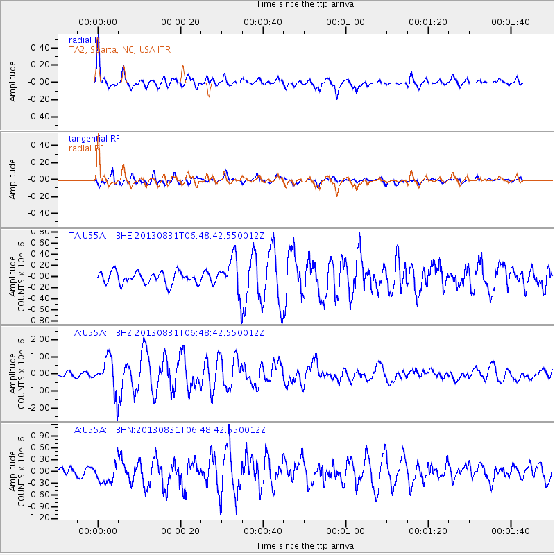
Signal To Noise
| Channel | StoN | STA | LTA |
| TA:U55A: :BHZ:20130831T06:48:42.550012Z | 4.851971 | 1.0223249E-6 | 2.10703E-7 |
| TA:U55A: :BHN:20130831T06:48:42.550012Z | 2.1220639 | 2.7386272E-7 | 1.290549E-7 |
| TA:U55A: :BHE:20130831T06:48:42.550012Z | 3.1017792 | 3.3196557E-7 | 1.0702424E-7 |
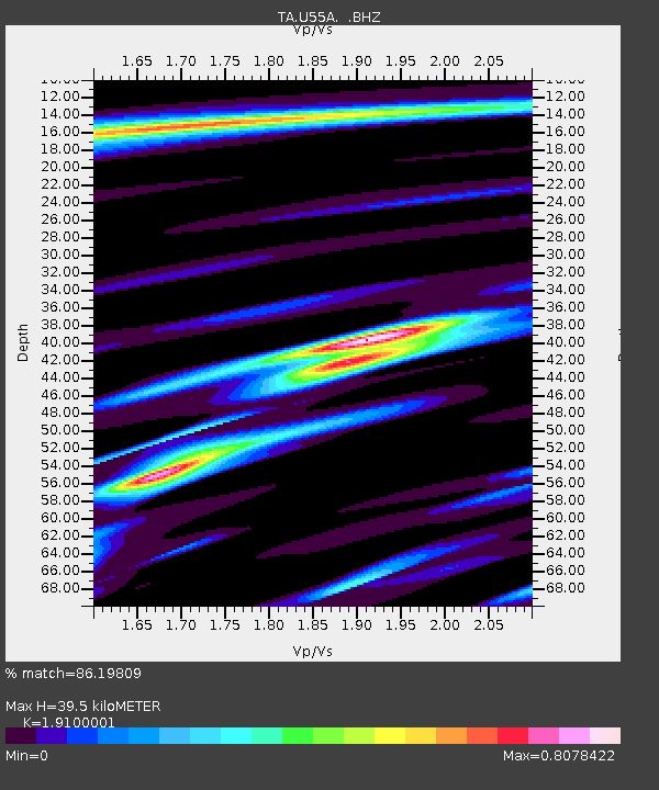
| Arrivals | |
| Ps | 6.0 SECOND |
| PpPs | 18 SECOND |
| PsPs/PpSs | 24 SECOND |

